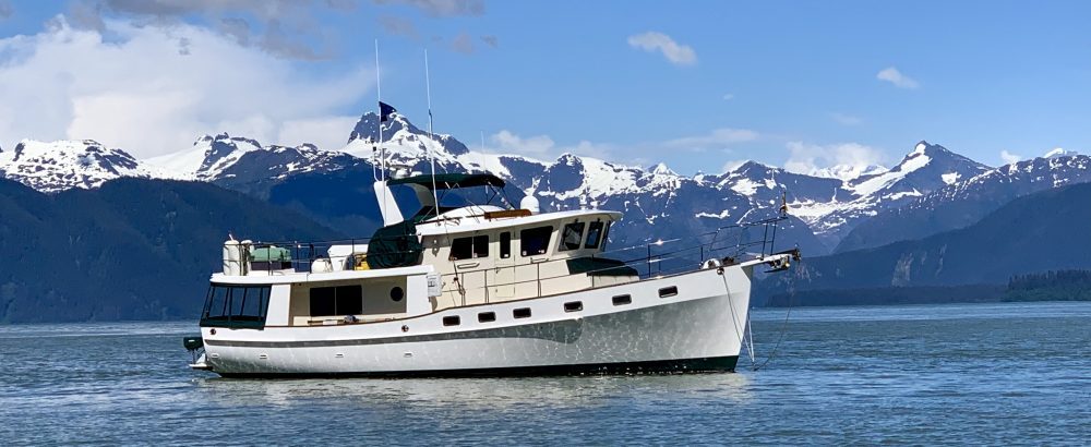
1/15/07 Today is the official start of our “Great Loop” cruise.
We are leaving Chattanooga today with “the gang”.
The “Great Loop” is a 6,000 mile plus waterway which circumnavigates the Eastern United States and Canada. We will travel down the TN River and Tenn-Tom waterway to Mobile, AL. From there we will continue east along the northern Gulf. We will then head up the East Coast of the United States to the Great Lakes and eventually Chicago and then to the Mississippi River where we will connect with the TN River which will bring us back to our home port of Chattanooga, TN. We plan on doing this over several years with a return down the East Coast of Florida this winter and perhaps the Bahamas. We may even make a trip back to Chattanooga before closing the loop. Many people do the loop within a years time. However, in talking with other loopers, we have decided that you really need 2-3 years to really see all that there is to see. We want to take our time and enjoy the adventure itself. At this time we have no specific plans other than to eventually close the loop. Guess you will have to stay tuned to see where the journey takes us.
After loading the final things and animals aboard, we pull away from the docks at 10:00 AM. It is a dreary day but at least it is not raining yet. Hopefully, we will make it to our anchorage, Little Cedar, above the Nickajack Dam before the bad weather moves in. The captain of Master Plan comes out on the docks as we are pulling away to wish us a good trip. We had 7ft. of depth coming out into the channel. We were a little unsure about how the depths would hold here. IT draws 5 ft. Everyone had said there would be no problems. They were right. We arrived at Chickamauga Lock to find the doors open and the chamber empty and waiting on us. After a quick lock down, we are on our way again. The rain started just as we are rounding Moccasin Bend. The dogs have not been for a walk yet and I am sure they will not want to go once the rain is here. They are quite content asleep at our feet in the pilot house. Sebastian wore his red scarf today to celebrate our departure.
1/16/07 We are up early to take the dogs for a “walk”. Still no luck. Jeff brought some leaves from our back yard at home and has put them out on the side deck along with the indoor/outdoor carpet.
01/18/07
We spent the day yesterday in Guntersville. Lynn Haxton of Toucan Canvas was here at 9:00 AM to measure for our Sumbrella bike cover. She made a pattern and said she would be back that afternoon with the finished product. Is that service or what? We were able to do a run into downtown Guntersville (5 miles roundtrip). It was good to be able to get some aerobic exercise in. Being able to exercise is a challenge for us on the boat. We will try to take advantage of every opportunity. We also took the dogs for several long romps. Lynn was back at 6:00 PM with the finished bike cover. It fits perfectly.
We would highly recommend her to anyone wanting canvas work in this area. She was great to work with. Lynn, thank you very much!
Today, we are leaving at first light in order to make it to Joe Wheeler State Park before dark. We have 73 miles and one lock ahead of us. We arrive at Guntersville Lock to find no barge traffic. The lockmaster has the lock ready for us when we arrive.
The Guntersville Dam is 3979 ft. long and rises 94 feet. Construction began in 1935 with a cost of $54 million. In 1965 a second larger lock was added and is the one in use today.
Guntersville Dam is a TVA dam. It was built for flood control and power production. They can produce more than 700 million kilowatt-hours every year.
We reach the Southern RR Bridge at mile 304.7 and ask for a raising of the bridge.
We have no wait time on this bridge either. We are still the only ones on the river. We have only seen one houseboat heading upstream earlier today.
Tonight’s destination is Joe Wheeler State Park. We were here for a week last October for the Great Loop Rendezvous. ( See previous logs) The park is named after General Joe Wheeler, a regional hero. Wheeler was a graduate of West Point. At the start of the Civil war, he resigned from the army and joined the Confederates. He later served nine terms as a U.S. congressman. In 1898, during the Spanish-American war, he was one of the few Confederate officers allowed to join the U.S. Army. Wheeler was also a major supporter of the development of the TN River. His efforts eventually led to the development of the TVA and the reality of a navigable river.
1/19/07
We enjoyed a nice dinner at Joe Wheeler Resort last night.
We were the only people there. After dinner, Jeff plotted our course for the next few days on the Nobeltec Admiral chart plotter. We leave the docks at first light. Wheeler lock is only two miles away. We have a zero wait time at this lock also. After exiting the lock, we are now in Wilson Lake. Unlike other TVA lakes, Wilson’s shoreline is almost entirely privately owned and is not controlled by TVA. Fifteen miles later, we arrive at Wilson Lock. The 93 ft. lift of Wilson Lock is the highest on the TN River and one of the three or four highest in the world. There is also a double auxiliary lock which we used when we were coming up the TN River last year. I am glad we are able to use the main lock chamber instead of the double lock thru on the auxiliary. The lock is extremely impressive. Once lowered in the chamber, we feel like ants in the bottom of a barrel.
Boy, I hope the doors hold. Water is gushing thru the seams. It makes you wonder what would happen if the door broke loose. The upstream gate is different than any we have seen. Instead of opening like barn doors, it lowers down under the water do a depth of 16 feet.
The doors on this lock were damaged by a barge last fall and the lock was closed for several months. Barge traffic was at a standstill. The auxiliary lock was also down for routine maintenance at that time.
We pass the Natchez Trace Parkway Bridge at mile 236. Today is the first time we have seen the sun. It is still cold with a NW wind at 10 mph. Sebastian says it is still too cold to go out for a “walk”.
He knows we will be at a marina tonight so he is holding out. We turn off the TN River at mile 215 into Yellow Creek. This is the beginning of the Tenn-Tom Waterway. We arrive at tonight’s destination, Aqua Yacht Harbor, around 4:00 PM. We have 448 miles to go until we reach Mobile, Alabama. So far, we have traveled 262 miles on the TN River.
1/20/07
Today we begin our journey down the Tenn-Tom Waterway. We have four locks ahead of us before reaching our final destination of Smithville Marina. This waterway will be much narrower and curvy than the TN River. We will really have to be careful of approaching barges. They are much bigger than us and have the right a way. We do have Automated Identification System (AIS) on our computer. With AIS we can pick up a signal from the barges several miles before we can see them. The AIS will tell us their name, position, heading, and closest point of approach. We can then call the barge on the VHF ahead of time and let him know our position. AIS was very useful on our trip up the Tenn-Tom last year.
The Tenn-Tom Waterway was officially opened in 1985. The total cost was two billion dollars. It is the largest civil works project ever undertaken by the Corps of Engineers. More dirt was moved to build the Tenn-Tom than was moved to build the Panama Canal. The system is five times longer and has a total lift 3.5 times greater than the Panama Canal. There are twelve locks on the Tenn-Tom Waterway.
The first section we are traveling thru today is called the Divide Cut. It is a 39 mile long canal and took longer than any other section of the waterway to construct.
Just before exiting the divide cut, we pick up our first target on the AIS. As we round the bend, we see the up bound barge. He tells us to pass on the “two whistle” which means starboard to starboard. The channel is very narrow at this point. We have maybe 15 feet between the barge and us. The landscape has changed drastically. We see many marshy areas with tree stumps sticking up out of the water.
It is very shallow just outside of the channel. We also pass several log chipping mills today.
Just as we are entering Rankin Lock, the third for the day, the generator overheats and shuts down. We use the generator for our hydraulic bow thrusters. Jeff thinks the problem is a bad impeller. The generator had shut down on us last night while trying to dock. At that time we thought that we had overloaded it by also running our heaters. This is not the case today. We were running nothing on the generator when it shut down. Without the generator, we can not run the heaters. Sebastian says “some vacation you guys are taking us on”. Once at dock in Smithville, Jeff changes the impeller. It was all chewed up. He is 99% sure that this was our problem. The generator seems to be running fine now. We will try again tomorrow.
1/21/07
We are leaving today in rain. Our destination tonight is Columbus Marina. It is only 43 miles away. We will have three locks to lock thru. All of the locks on the waterway are a standard 600 feet long by 100 feet wide. They have an average lift of 30 feet. These locks are much newer than the TVA locks on the TN River. The lock operators have been very helpful. Because the locks are so close together, they call the next lock for you and let them know that you are coming. So far the next locks have been standing by for us. We call Wilkins Lock before untying from the dock. We are only five minutes away and want to make sure there is not a wait at this lock. The lockmaster says that he can take us now. After an easy lock thru, we are on our way to Amory Lock which is five miles away. They are waiting on us when we arrive. Since leaving Bay Springs Lake yesterday, we have been in the 45 mile long canal section of the Tenn-Tom Waterway. This lateral canal uses hillsides for one bank and levees for the other bank. The maximum width of the canal is 175 feet with five miles having an average of only 75 feet. Luckily, we have not seen a barge is this narrow section today.
The generator seems to be running fine. We now have full heat and bow thrusters. We are sure that the impeller was the problem. The impeller is a round rubber part inside the water pump that forces water into the engine. Without it, the engine will quickly overheat.
The river is starting to get busy. Just before Aberdeen Lock, we pass, Bolivar Point, an up bound tow. We have to wait about 30 minutes at the lock for a second tow, Kay Templeton, to lock up. Luckily, that was our last lock of the day. During the lock thru, I have to tender the lines at the bollard. It is too cold and wet today to be outside. But I have to be none the less.
About two miles after locking down, we pass a third tow, Decatur. We pass our fourth tow of the day, Pimlico, at mile 349. All of the barges today have been carrying hazardous liquid cargo. The AIS information says they are all going to Decatur, AL. The AIS picks up our fifth tow, Caddo, 6 mile further down river at mile 343.
We arrive at Columbus Marina in Columbus, Mississippi around 4:00 PM. The dogs are happy to go for a walk on real grass. They have been asleep in the pilot house all day. The weather was too miserable even for them.
Jeff transfers some fuel to our main tank. We have a port tank (300 gal.), starboard tank (300 gal.) and a center main tank which holds 325 gal. We transfer fuel from both the port and starboard tank into the center tank from which both the main engine and generator are supplied.
1/22/07
Today was a rest day at Columbus Marina. We rented a car and toured the sights of Columbus. We drove 23 miles to Pickensville to visit the Bevil Lock and Dam Visitor Center. Here one can learn about the natural history and construction of the Tombigbee Waterway. The U.S. Snagboat Montgomery built in 1926 is displayed here. This restored sternwheeler steamboat is a National Historic Landmark.
The 180 foot vessel removed submerged stumps and fallen trees from the inland waterways for most of this century. The Montgomery has been restored to near original operating appearance and now provides a glimpse into a bygone way of life.
We also visited the Waverly Mansion in Columbus.
It was built in 1852 and is one of the South’s most impressive antebellum homes. It sat vacant for 50 years and was bought by the current owner, Mr Snow, 20 years ago. He has lovingly restored the mansion and has many fine antique furnishings throughout. At 81 years of age, he lives there alone and maintains the property as well as raising peacocks. The oldest and largest magnolia tree in Mississippi is on the property.
Some interesting statistics on our trip so far:
Total miles traveled: 367.5
Total fuel used: 150 gallons
Main engine avg. gallons per hour: 2.65
Avg. Miles per gallon main engine:2.89
1/23/07
We are leaving Columbus Marina today on our way to Demopolis which is 119 miles downstream. We can not make Demopolis before dark so we will anchor out tonight somewhere half way. There is nothing between here and Demopolis. We call Stennis Lock before untying as they are only a few minutes away. The lockmaster says that he has the chamber ready for us so we head that way. Once in the chamber, the lockmaster asks us for our U.S. Coast Guard documentation number and destination. This is the first time any of the locks have asked for this. We had read that this is standard procedure. They are checking for any illegal boat traffic.
We arrive at Bevil Lock three hours after leaving Columbus.
This is our ninth lock of the trip and the last one for today. We had driven the car here yesterday to tour the facility. It was a thirty minute car ride. You don’t go fast by water but it is more relaxing. Seeing the Snagboat Montgomery by water gives you a different perspective.
After Bevil Lock, we cross the Alabama and Mississippi state line several times. The river twists and turns for many miles. Coming around one bend we spot a red phone booth out in the middle of nowhere.
We have no cell service here and thought about stopping to make a call. Since mile 366, we have been in the River Section of the Tenn-Tom. This section has been much wider and deeper than the Divide Cut or Canal Section. We are averaging 25 feet of depth in this section versus 12 feet in the other sections.
At mile 284 we pass a Coast Guard work tug, Wedge, pushing a barge full of channel markers. They are replacing some of the many markers that have been moved by current or barges. We have seen many markers washed ashore earlier today. They certainly have their work cut out for them.
We anchor at mile 277 at the Cooks Bend Cut-off. This is part of the old Tombigbee River. It would be a nice area to explore in the dinghy if it wasn’t so cold outside. The dogs see the shore and keep glancing at us. Daisy keeps looking at the shore and then the water.
We will see what happens tonight. We are not taking them ashore!
1/24/07
Jeff is up at 6:00 AM to take the dogs out. Someone had told us that you will have more luck in the dark because they can not see the shore. We decided to leave them outside by themselves. They pace around the deck for about 30 minutes. A few minutes later, I look out the pilot house window and see Daisy and Sebastian doing their business on the front deck. Oh happy day!!! They get lots of praise and dog treats. Hopefully this will be the start of more good things to come. They seem very pleased with themselves.
We pull up the anchor at 8:00 AM. This was a very nice anchorage. We would like to come back here and explore sometime. Tonight we will be at Demopolis.
We arrive at Hefln lock at 9:20. This is our only lock of the day. We call the lock master and a woman’s voice answers. This is the first female lock operator we have experienced. We have to wait while they fill the chamber. It was set for a downstream lock up.
At Mile 249 we arrive at the white cliffs of Epes.
These white clay cliffs rise 40 or more feet above the river. It is one of the most dramatic sights on the Tombigbee River.
Mile 225 marks our halfway point between the Tennessee River and downtown Mobile. Mile zero marks downtown Mobile. From there it is 12 miles thru the Mobile shipping Channel to the Gulf of Mexico entrance. It should be quite busy going thru the shipping channel.
We are the only boat on the river today. We have not seen any barges or other pleasure craft. It is surprising to me that more people do not enjoy this wonderful waterway. Of course though, it is the middle of January. We may be the only fools on the water. We are starting to enjoy the solitude of the river. In a way it is sad to think that we only have a few more days before reaching Mobile Bay and civilization once again. At mile 217 we reach the mouth of the Black Warrior River. At this point we are leaving the Tenn-Tombigbee Waterway and entering the Black Warrior-Tombigbee Waterway. One mile further and we arrive at the Demopolis Yacht Basin.
We see the fuel dock at the entrance with its huge pylons.
Towboats refuel here. These tows can take on 5000 gallons or more. I have heard that the record is 35,000 gallons. The marina tanks hold 90,000 gallons. That is a lot of fuel. We radio the marina and they give us directions to our slip. We are on the T dock so it is an easy docking. From our slip, we look directly out into the main channel of the river.
We are docked next to “Damtootin” a 36 ft. Willard owned by Nancy and Walt. They were at Columbus Marina when we arrived. They are on their way to Florida.
The dogs enjoy a walk over to the nearby park where we all get some exercise in. After dinner aboard it is early to bed as usual.
1/25/07
We are up early doing our daily chores which include bird feeding, dog walks, engine room checks, and planning today’s navigational route. We have started letting Nate come out and visit on his t-stand in the pilot house each morning while Homer visits in the saloon.
They seem to like this very much. We still can’t let them out of their cages together in the same room because they get too wild. They are like having a pair of three year olds on board.
We are ready to pull away from the docks at first light, 6:30 AM. We were treated with homemade blueberry muffins complements of Walt and Nancy on the Willard boat next door. It was a thank you for helping them dock their boat yesterday. Their engine died just as they were pulling into the slip and Jeff helped with their lines. It was very nice of them to send over the muffins.
Demopolis Lock, our first and only lock of the day is 2.5 miles away. Nancy and Walt will lock thru with us as they are leaving at the same time. It is hard to believe that we have only one lock remaining from here to Mobile. We have decided to run faster today (11 mph). We will try to make Bobby’s Fish Camp which is 100 miles away. This is a push but there are not many anchorages on this stretch. We would probably have to anchor just outside of the channel on the main river and we would prefer not to. We have 1.5 knot current going with us so we should be able to reach Bobby’s before dark.
Today is a beautiful day. This is the first day of the trip that we have seen the sun. There is not a cloud in the sky. The water is sparkling like a million white diamonds from the suns reflection. We have seen several river otters poking their heads out of the water. At mile 187 the river begins a series of hairpin turns. It snakes its way thru the countryside.
Although the river is only a few thousand feet to our starboard side thru the trees, it will take us almost three miles by water to get there. In the 1800’s these turns made navigation for the steamboats very treacherous and there were several that sunk and remain on the river bottom today. Even today barges find this section difficult to navigate. We have seen several red and green buoys that have been chewed up by the barges.
At mile 148 we have a tow, The Alison Haun, up in front who is also going south. She is pushing 12 barges of coal. This is the first tow that we have had to overtake. She is going 7.6 mph and we are doing 11 mph. We will have to overtake her. This is one of the absolute worst places to pass. There are many snake bend turns for the next 8 miles. We radio the Alison Haun and advise that we are behind her and will wait on a straight section of the river to pass. Jeff does not want to pass with these hairpin turns. She would squish us like a bug if we were in front and our engine died or we hit something. The Captain of the Alison Haun tells us to “get with the program and come on around now”. We have a one mile stretch in order to make it past before the next turn. We are really not comfortable doing this but we do as advised by the tow boat. We apply full throttle and our speed jumps to 13.5 mph. We are making our fat lady run. We arrive at the bend just in front of the tow. He is on our tail. Whew! I thought cruising was supposed to be relaxing.
We arrive at Bobby’s Fish Camp at 4:30 PM, well before dark. This is our longest day of the trip so far, 97.2 miles. Luckily, no other boats are here. There is only room for one boat. Bobby’s consist of a 30 ft. floating dock and a fuel pump. There is a store with a restaurant up the hill.
We are docked right on the river with a good current going downstream and a good view. About 6:30 PM the Alison Haun comes barreling down river. This was the tow that we had to pass earlier in the day. The throb of his engines penetrates our hull. We wave at the tow and the entire crew waives back.
1/26/07
During the night we could hear the tow boats as they pass on our starboard side with their cargo. It was a little eerie lying in bed knowing that these huge tows were only a few hundred feet away. The dogs barked at each passing. They were as nervous as I was. Jeff slept like a log thru it all.
There is frost on our decks this morning. We have bright sunshine. We reach our last lock of the trip, Coffeeville Lock and Dam at 8:00 AM. We have only a ten minute wait while they fill the chamber. It is amazing that our longest wait at any of the twelve locks on the Tenn-Tom has been thirty minutes. There are times when pleasure craft have to wait two and three hours while barges lock thru. We have been very lucky on this trip. There is a tremendous amount of debris in the water at the entrance to the lock. We have to pick our way thru carefully. After leaving the lock we are now in tidal waters and are now less than four feet above sea level. We will have to consider the tide when maneuvering from now on. When we exit the lock, a thick fog bank envelopes us.
We slow to a moderate speed, turn the radar on, and pick our way along the river dodging debris. The fog becomes thicker and we can only see about 100 yards in front of us.
Luckily, we are not picking up any targets on the AIS or radar. We slow to about 6 mph. After about a mile the fog lifts to reveal a beautiful clear morning.
At mile #89.9 we reach the Southern R.R. Lift Bridge. He calls and asks what our vertical clearance is. It is 30 feet to the top of the antennas. He replied that his power was out for the next hour and he could not raise the bridge. He thought there was 26 feet of clearance but was not sure. With our antennas down we have 19 ft. of clearance. We lower the antennas and slowly proceed. We hope he is correct in the 26 foot estimate. We inch under and clear under by 7 feet. I guess he was correct.
At mile 83 we hear the up bound tow, Brenda Rose, call out her position at mile 79. This is just at the beginning of another series of sharp snake bend curves. Wouldn’t you know. Why can’t we meet these tows on a straight section of the river? We call Brenda Rose and give her our position. She tells us to pass on the one whistle at the next bend. As we approach the bend we can not see her yet but we know she is there because of the AIS. Just as we round the sharp bend, her massive bow appears also at the top of the curve. We have about two feet between us and the green channel marker at our meeting. Once she is past us, we have to be careful of her terrific prop wash so it does not push us into the bank.
Other than the tows, we still have not seen any other boats since leaving Demopolis. I guess this is because the 213 mile Demopolis-to-Mobil run requires self-sufficiency on the part of transiting boaters. Access to fuel is only periodically available at Bobby’s Fish Camp and you must be able to handle any mechanical problems on your own. This section of the river is wide, deep, and meandering.
Oh no!! The Alison Haun is up ahead again. This is the boat that we had to pass yesterday. And guess what? Another 90 degree bend is one mile down river. We call the Allison Haun and the captain says to pass on the two before the bend. So I guess that means we have to pass. This bend is so sharp he has to reverse his engines at the bend to fit around the corner. We go full throttle hoping to make it before the bend. We reach the corner just before she does.
She will probably pass us again tonight while we are at anchor.
We come to the 14 Mile Swing Bridge at mile 13.
I don’t know why they call it the 14 mile bridge. Our anchorage for tonight is at mile 12. We go about a mile up the Tensas River Cut Off and anchor in about 10 feet of water. I hope no barges will come down this river as we are in its center. The Tensas River rejoins the Tenn-Tom again at mile 39. Jeff does not think the barges use this cut off any more. It is a very pretty spot. Today was the longest day so far (106.9 miles). Tomorrow we will only have 12 miles to the Mobile Shipping Channel and then another 12 miles to Fly Creek and the town of Fair Hope, AL. Today was a very long day with lots of nail biting encounters (at least for Susie). However, we are still alive to tell the story!
1/27/07
The Tensas River Cut Off is a great place to anchor. We understand it is used by locals for a hurricane hole. The surrounding bayou created quite an echo.
This confused the dogs. They start barking at their on echoes. Sebastian’s hair was raised on his back and he was all riled up. The more they barked the more it echoed and finally we had to bring them inside to calm them down.
We have taken the dogs out several times and they have not used the facilities. We are hoping for a repeat of the other day. So far it has been 26 hours! They are apparently holding out for the green grass at Fairhope, our destination for tonight. I don’t know how they hold out so long.
At mile four we see the skyline of Mobile ahead. It seems strange to see tall buildings.
We are definitely back in civilization. We are picking up 36 targets on our AIS. Most of them are not a threat because they are at dock having their cargo either loaded or unloaded. Mobile is a very busy shipping port.
Last night we keep the vhf radio on all night listening to the barge traffic. Tows are going every which way thru the channel.
We pass the Alison Haun in downtown Mobile. This time she is tied to the docks unloading. This should be the last time we have to pass her.
We exit the Mobile Ship Channel at red marker #72 and steer a new course thru Mobile Bay for twelve miles to the Fly Creek Cannel. Even though the bay is quite large, it is very shallow. We are showing eight feet. Several porpoise sprint across our bow. We enter the Fly Creek Channel and see our marina at port.
After securing IT in her slip, we take the dogs out for a walk as they have held out for over 30 hours. I guess they win this one. We borrow the marina courtesy car and head for downtown Fairhope. We pick up our weekly mail drop at the Fairhope Yacht Club. The downtown is very charming with many shops and restaurants. There is a very nice park and fishing pier right on the water. We will spend the next two days here and explore the town. The rain arrived this afternoon but should clear out by tomorrow. We have an unobstructed view from the boat looking west onto Mobile Bay. We have enjoyed watching the pelicans, egrets, and herons this afternoon from the pilot house. Dinner tonight is fresh seafood from the local market.
Statistics for Chattanooga, TN to Mobile, AL:
Total miles: 717.6
17 locks
3 nights at anchor
15 nights at marina
Fuel consumed: 275 gal.
Operating engine hours: 86.3
Generator Hours: 46.2
Main engine: 2.65 gph
Main engine: 3.14 mpg
1/29/07
The wind howled all night last night. We had gust 25-30 mph. Jeff doubled up our lines before going to bed. When we woke this morning the wind had died down but our boat was tilting to port. We were on ground.
The winds had blown the water out of the bay and IT was hard on the bottom at low tide this AM.
Before the storm we had plenty of water where we are located.
I have read that when the wind blows very hard all of the water is pushed out of the bay. This is exactly what has happened. It is quite amazing to see all of the boats in the harbor over on one side. Some are tilting much worse than we are. I guess it is a good thing we were not planning on leaving today anyway. It is also very cold. We had a hard freeze down to 26 degrees last night. I thought we were leaving Chattanooga to get away from the cold.
We have enjoyed the last few days touring Fairhope. It is about three miles into town. We have ridden our bikes in each day. The town of Fairhope is a very charming small town. The town had done a nice job of decorating with many flower boxes and curbside plantings.
Everyone has been very friendly. There is a very nice park and fishing pier right on the bay. It has an immaculate main street of quaint shops with three traffic lights. Southern Living has rated it as one of the top retirement cities in the U.S. I can understand why. You would not be disappointed with a visit here.
Sebastian and Daisy have enjoyed their daily runs and also beach combing. They seem interested in everything. There are many new smells for Sebastian and birds to chase for Daisy.
When we checked into the marina on Friday, we saw there was someone here on a sailboat from Knoxville, TN. This morning Jeff met the couple while walking the dogs. It turns out they are Bill and Sue Shafer and they used to live in Chattanooga and were also divers at the TN Aquarium. What a small world! We had them aboard this evening for wine and cheese. We enjoyed our visit with them. We made plans to leave with them in the morning as soon as it is light. This is assuming we are not aground again. Right now the tide is high and the water is back in the bay. Low tide tomorrow is 9:00 AM. We will be leaving a couple of hours before this so hopefully we will have enough water depth. I guess we will see in the morning. Our plan is to be in Pensacola tomorrow evening.
Looks good so far! Maybe try putting a fire hydrant out for the dogs? Travel safely and we’ll talk to you when you get down this way.
Chris
Really enjoying following your travels and seeing your pictures!
Rock on!
As your toxicologist, I recommend that you steer clear of those hazmat barges. Generally, they are safe, but when they’re not, they’re really not! We’re doing a bit better in terms of weather than you are, but not much. It’ll be 36 tonight here, and colder on Friday night. There were about 5 boats in the 38 to 50 foot range berthed at the Moorings last weekend, itching to make the crossing. The weather would have made it a very unpleasant trip across! About 10 years ago I made the crossing from Tampa to St. Marks at night in my Dad’s 37 foot sailboat, crystal clear sky, bright stars, 3/4 moon, and dolphins cruising along through the phosphorescence. Also did it about a year ago from tarpon Springs to carrabelle in the 56 foot landing craft. Needless to say, an entirely different trip.
Talk to you whenever.
Chris
Just wanted to let you know that we’re thinking of you guys. I loved reading it all! So glad your safe and well. Send more pictures!!! I can’t wait to hear some of these stories first hand. HUGS to you both.