itadmin
Maine to The Chesapeake: Fall 2008
Solomons to Great Bridge:
When it comes to boating, the weather determines your schedule. All of our work is completed and we are ready to move on. Mr. Weatherman decides otherwise. We check the forecast and it is really lousy for the next week. There is a front headed our way. We wait patiently for the next few days as the rain and winds arrived just as forecast. The one good thing about this delay is that it gives us a chance to make good on our dinner promise to Bruce from Bristol Electronics. He really helped us out one Friday evening while we were in Salem, MA and our batteries quit charging. A quick call to Bruce and the problem was solved. We had promised him a dinner for helping us with this problem. We have a great meal with Bruce and his wife Donna at the CD Café on election night. This is just a small little place with only about 10 tables located in an office complex downtown but is one of the best restaurants along the east coast. We have never had a bad meal here. The place is always packed with locals. The chef does a great job of creating wonderful culinary dishes. Jeff and Bruce chose the special of snapper stuffed with crab. Donna and I both stuck to the Mediterranean Pasta which is one of CD’s specialties. The remaining evening is spent watching the presidential election returns.
The winds finally calm down enough for us to continue making our way south. The daylight hours have become very short. This makes it hard to travel any great distances on the boat. Several other boats are leaving the docks this morning also as they too have been stuck here waiting on the weather to improve. We are the first boat to pull away from the docks at 6:00 AM and it is still dark. This is an easy harbor to navigate and having traveled it several times, we feel comfortable leaving before sunrise. Out in the Patuxent River, the daylight is slow to arrive.
It is a grey day out on the water but we do have calm seas. As we approach the Patuxent Naval Air Station’s bombing range, we listen for any warnings over the VHF. The military routinely does target practice out in the bay with areal bombings and live fire on these targets.
When they are practicing, all boat traffic must detour around this area. Today we hear no warnings so continue on through the bombing area. We are pushing IT as hard as she can go in hopes of making it to the Hampton Rhodes anchorage just outside of Norfolk before dark. We soon pass the entrance to the Potomac River. The sun finally appears and we have a great day on the water. We continue to watch our estimated time to the anchorage. It ranges anywhere from 5:00 to 6:00 PM. The sun has been setting around 5:00 PM and it is pitch dark at 6:00 PM. IT is going a fast 10 MPH in hopes of making the anchorage before dark. Luckily, we arrive to our anchorage just as the sun is setting and manage to have the hook set before darkness sets in.
While in Solomons, Daisy and Sebastian also received a new piece of equipment. We replaced their piece of sod with an artificial piece of turf like that used in football stadiums.
We decide that this would be a perfect opportunity to give this new grass a try. We really don’t want to put the dinghy down in the dark just to take them ashore. We spend the evening “walking” the two dogs on the front deck repeatedly telling them to “hurry up”. Sebastian keeps going to the back deck in anticipation of hopping in “his boat”, the dinghy. Daisy continues to gaze at the shore each time we take them out. As the evening progresses, Sebastian balks on even going outside. They both look very pitiful. They refuse to use this new grass. We stubbornly hold out and refuse to take them ashore. The battle of wills has begun. The next morning, we repeat the process of walking them on the front deck. They still refuse. It has now been 24 hours since they have been ashore. Just before pulling up the anchor, we decide to give it one more try. Sebastian gives in and reluctantly uses his new turf. He has the most painful expression on his face while using his new grass.
We give him lots of praise and treats. A few minutes later, Daisy too uses the turf. It is a successful morning and we are now ready to continue on to Great Bridge.
As we approach Norfolk, we see many Naval vessels lining the docks. It is impressive seeing all of these war ships.
Several container ships are leaving the harbor and we cautiously get out of their way. I had forgotten how big these things are.
We soon reach the Jordan Bridge, our first of several for this next section. There is a delay on the opening and we must wait about 30 minutes. We are going through one of the last openings of this bridge. Today is the last day that this bridge will be in operation. We learn that at 12:30 the bridge will be raised and left in that position permanently. This bridge has been declared unsafe for car traffic and they are taking it out of commission.
We are joined by a fleet of other boaters all traveling south as we work our way down the Elizabeth River. We all stay together in a line as we have three more bridge openings and a lock to go through. The bridges open on the hour and the lock on the ½ hour. Everyone is cruising along in a line when three new boats join the group from behind. We are the last in line and these three boats all decide to pass us. Where do they think they are going? Everyone must travel through these bridge openings and locks together. They pass two other boats before deciding to follow along like everyone else. We now have 13 boats all traveling together and we are last. I hope there is room in the locks for all of us. If not we will end up waiting on the next opening which would be an hour later. I will be really upset with those three boats if they get in the locks and we don’t. I guess boaters are just like car drivers. Some just seem to think they are the only ones on the water and have no manners.
We are soon through the bridges and arrive to the locks just minutes before the opening. We patiently wait as the boats file in one by one. Luckily, there is still room and we take one of the last spots. The lock attendants are very helpful securing our lines to the bollards.
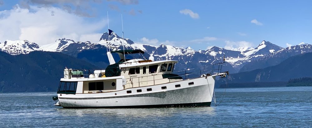
We are lifted only 2 feet. As the horn blows and the lock doors open, the boats file out one by one. All of the boats seem to be in a rush and again are bunched up as we have to wait on the bridge just yards ahead of the locks to open. What is their hurry? As the bridge opens, we can see our marina, Atlantic Yacht Basin, just ahead. We have an easy docking just in front of the fuel docks. It feels good to be back here after six months of traveling almost 2500 miles. From our boat, we will have a front row seat for all the watercraft traveling down the ICW.
Total Miles Traveled Solomons to Great Bridge: 132
Total Miles Traveled Year to Date: 2474
The Green Machine
Things have been very busy aboard IT the past few weeks while here at Calvert Marina in Solomons, MD. Scotty, from Bristol Technology, and Jeff have worked day and night making IT the new “Green Machine”. Their first project was to install two solar panels.
These were mounted over the pilot house. On a sunny day, each panel should provide 8 amps of charge to our battery bank. Scotty and Jeff next installed an Air Breeze wind generator.
We decided to install this in the upper starboard rear corner of the boat. This location allows for unrestricted air flow and eliminates the possibility of anyone walking into the blades. The unit is also set 8 feet off the deck as an added safety measure. With a strong wind, this will add an additional 26 amps to our battery bank. We are pleasantly surprised by the low noise of this unit. The noise had been a concern for me. We selected this brand specifically because it was designed to be far less noisy than the older generation of wind generators. From inside, we can not even hear when it is running. These two items should cut down our generator time while at anchor from four hours to two hours per day or less.
Our next major addition aboard IT was a water maker. For this we chose a Spectra Water maker. We decided to install this down in our fresh water hold in the hall between the guest and master stateroom.
This space was used to store drinks and other items so now we have to find new storage locations for these things. Luckily, we have plenty of storage room on the boat so it should not be too much of a problem. It will be nice not having to scrimp on water while taking showers. We can now make 35 gallons of water per hour using reverse osmosis. No more “Navy Showers”.
Jeff and I spent several days enrolled in Kirk’s “Varnish 102” class. While here in the spring, Kirk was kind enough to teach us “Varnish 101”. During the spring, we were only allowed to tape and help Kirk sand the teak cap rails.
In this class, we were given a free reign to sand and Jeff even applied one coat of varnish. After sanding off the top layer of varnish, Jeff applied the first coat of varnish. Once this dried, we sanded that off also. It seems a shame to sand off something that looks so good. It is also a lot of work. It takes Jeff and me a day and half just to sand all the cap rails. By the end of the day, both our fingertips are raw. Although Jeff’s varnishing has improved greatly over the past year, he still did not feel comfortable putting on the final coat. We have Kirk apply this final layer.
Jeff did varnish both sign boards and did a really good job. IT now has two more coats of varnish on the teak.
After a week of sanding and varnishing, there were still many other projects to complete aboard IT while here at Solomons and we both stayed very busy getting ready for our trip south. Jeff donned his snorkeling gear and scrubbed all the grime off the hull. He wishes he had done this a week earlier as the temperatures have dropped into the 40’s and the water was very cold. While he did that, I scrubbed our fenders trying to get all the accumulated dirt and grime off them. We also had some minor warranty work done on the fiberglass while here. There were a few hairline cracks along the port side rub rail. Spring Cove Marina did a great job of repairing these. The boat is washed and all the stainless polished. It has been a busy few weeks but IT now looks like a brand new boat once again.
In between all the work, we have enjoyed visiting with all the boats as they have come and gone each day on their migration to Florida. We have seen many loopers here as they stop overnight for their trip south. “My Sharona” with Wayne and Sharon aboard, spent a week docked next to us. It was great spending some time with them. We first met them earlier this year while in Boothbay Maine. One day they broke out their new toy, a stand up paddle board. We enjoyed giving that a try in the harbor. It is like a stand up surf board with a paddle similar to that of a canoe. Although not the most graceful, I at least didn’t fall overboard while paddling.
We were surprised by a visit from fellow looper Bob of “Bonus IV” who was traveling aboard “Ocean Flier” helping move the boat south. That same day, Betty aboard the Krogen 48 “LiLi” docked behind us. Jeff got a chance to show off his latest and greatest additions aboard IT. Phillip and Katherine aboard “Jaberwock” another Krogen 48 made a special drive down from Annapolis to have dinner with us one rainy evening. It was great catching up with them. We last saw Phillip on our climb to Kilimanjaro in February. We were sad to learn that they are selling their boat. They are building a wonderful new home near Asheville, NC so they won’t be too far away. The docks here at Calvert Marina have been busy these last few weeks. We are now ready to continue our trip south.
Chesapeake City to Solomons:
We are up early in order to escape the crowed Chesapeake City basin and all the crazy boats. It is a relief to leave all of these other boaters while they are still sleeping in their bunks. After transiting the remaining two miles of the C & D Canal, we soon find ourselves once again in the Chesapeake Bay. It is great to be back on the Chesapeake. The weather is good and the seas are calm for our trip to Solomons. It is a gorgeous day on the water and we see several sail boats out for an afternoon sail.
After traveling the waters of Maine, the Chesapeake seems so easy. We have none of the challenges found in Maine. There are no lobster pots, fog, or rocks to contend with. Last year we had thought that the crab pots here on the Chesapeake were difficult to maneuver around. Now they seem to be a piece of cake. I think the challenges of Maine have made us better boaters. We have an easy but long day arriving to Solomons at 5:30 PM. We soon see the Calvert Marina docks where there are four or five other Krogens berthed.
The Krogen Rendezvous was last weekend. We had hoped to be here for that but Hurricane Kyle delayed our trip. It is good to see some fellow krogens still here. Several owners quickly rush to the docks to help with our lines. This sure makes docking a lot easier and we are grateful for their help. This will be our home for the next month while we have some work done on IT getting her ready for the next leg of our trip. We will also make a quick trip home from here.
Total Miles Traveled Chesapeake City to Solomons: 102
Total Miles Traveled Year to Date: 2342
Anchoring 101:
After securely anchoring IT for the night at Chesapeake City, we settled in to what we thought would be a relaxing evening. Little did we know. Then comes “Day Sea May”, a 42 foot Grand Banks trawler.
We first saw “Day Sea May” while at Utschs Marina in Cape May. We watched as she approached Utschs from a completely different direction than we were told to enter their basin. At the time, we questioned the dock master and asked if there was an alternate route into their marina. He said “Day Sea May” did not follow their instructions and was very lucky not to have run aground the way that they entered. We also watched with amazement while “Day Sea May” entered her slip at Utschs. She was piloted by an 80 year old gentleman with another elderly man on the bow. They were shouting instructions to each other but apparently neither could hear what the other was saying. Lots of arm waving and gesturing occurred. There was also a younger couple aboard but they seemed to just watch and offered no help. After several attempts, they somehow managed to get the boat into the slip without any serious damage to themselves or others.
We once again found ourselves watching in horror as “Day Sea May” attempted to anchor. The elderly gentleman positioned the boat in front of us and instructed the other gentleman to drop the hook. He did so and “Day Sea May” started backing up and continued to back up. The man on the bow kept letting out line and the Captain kept backing up. As “Day Sea May” approached IT, Jeff went and stood on the bow giving them the “Parker Evil Eye”.
The captain kept yelling at the man on the bow to cleat off the line. The man on the bow seemed to have no clue. I don’t think either man could hear a word the other was saying. The younger couple finally involved themselves in the situation and suggested that they might be too close to our boat. There were several minutes of finger pointing and gesturing. We continued to watch in amazement for the next thirty minutes as they tried to pull up the anchor in order to retry. The man on the bow kept arguing with the captain that he could not pull up the anchor and that he needed to go forward. The captain kept going forward but still the man on the bow kept insisting that he could not pull up the anchor. The captain left his position at the wheel and went out to the bow several times to discuss the situation. The younger lady finally had all she could take and went over to the side of the boat and hung her head over her arm in disgust. Jeff couldn’t stand watching the fiasco any more and took the dogs ashore. They then tried to re-anchor and backed down within 10 feet of IT once again. I rushed out to the bow and told them to go forward as I was afraid they were going to hit us. By this time, Jeff had returned in the dinghy and went over to “Day Sea May” and suggested to the captain in as calm a manner as possible that the area behind us was plenty deep and there might be more room for them there. The old man replied “I have been in here many times and know where to anchor”. Jeff quietly returned to our boat and again watched from our bow giving them the “Parker Evil Eye”. After several more attempts, they took Jeff’s advice and successively anchored behind us. That was only beginning. Over the next hour, five other sailboats arrive and tried their luck at anchoring. With each boat, the anchorage became increasingly crowded. We once again find ourselves watching in disbelief as these boats anchor. The majority seem to have no clue on the proper way to anchor a boat. They just drop their anchor to the bottom and retreat down below. There is no setting of the hook or taking into account the swing of their vessel. Things finally quiet down and we begin to relax thinking surly no more boats will arrive this late in the evening. Then comes “Wind Chaser”, the worst offender of all. We had our first encounter with “Wind Chaser” while anchored off of Atlantic City. Like here, they arrived after dark and dropped their hook within feet of our bow with no regard to setting or swing. In Atlantic City, Jeff had quickly gone up to our bow once he realized their ineptitude. There he stood for about 30 minutes giving them the “Parker Evil Eye”. The captain finally asked how much anchor chain we had out. Jeff then questioned him about how well his anchor was set. He assured Jeff that it was fine, although we knew different. Needless to say, we didn’t get much sleep that night as we were worried about him crashing into us. Jeff was up several times during the night to check on the situation. As we see “Wind Chaser” getting ready to anchor just in front of us once again, Jeff quickly goes to the bow and once again gives them the “Parker Evil Eye”. “Wind Chaser” seems to get the message this time and quickly chooses a different spot. Unfortunately he tries to anchor really close to another trawler. This trawler politely suggests to him that he might try another location. We again find ourselves watching this anchoring fiasco for the next hour as “Wind Chaser” deploys and retrieves his anchor many times.
There is once again much gesturing and finger pointing between himself and his wife. On several occasions, the husband goes up on the bow, with hands on his hips, in apparent confusion of what to do. He finally selects a spot out of our range and once their anchor is down, they quickly retreat to their cabin. I hope he doesn’t swing into the boat next to him during the night. Who would have ever though anchoring could be so hard?
The Dreaded Delaware Bay:
We are leaving Cape May today with a lot of apprehension. We must travel the dreaded Delaware Bay. Our experience on this bay earlier in the year has put a high level of anxiety in our minds. Our worst boating experience ever was on this body of water. Earlier this year, we found ourselves in 8-10 foot seas and gust of 30 knots while navigating around huge freighters coming and going in both directions. It was a horrible day on the water. We just hope that today is not a repeat.
The dock master at Utschs felt like today would be O.K. He said we just don’t want a wind out of the west. The forecast is for 10-15 mph out of the north with gust up to 20 mph tonight. We check and double check the weather before leaving. It is not an ideal forecast. If we don’t go today it looks like we would be here for several days as the forecast is not good for the next few days. The wind is already picking up here in the marina when we are up at 5:30 AM and we are not really comfortable with our decision. Talking with the boat in the slip next to us, we learn they are headed back to Oxford, MD. He owns the boat yard there and has traveled this bay hundreds of times. We seek his opinion on today’s forecast. He thinks it will not be the best of days but that we should be O.K. We decide to give it a try.
It is low tide leaving the docks. Utschs Marina is a really tricky one to get out of. There is a channel which has been cut just off their bulkhead but there are no channel markers. You have to blindly trust their instructions to stay 20 feet off the bulkhead until out to marker #14 and the main channel. Our depth sounder alarm continually goes off showing six feet (We draw five feet). We hold our breath as we make it safely out of the marina to the protected waters of the Cape May Canal which is a man made cut connecting Cape May Harbor to the Delaware Bay. This three mile waterway was constructed by the United States Army Corps of Engineers during WWII. It provided a protected route for ships in order to avoid the German U-boats operating off Cape May. We soon pass the big ferry terminal and see the vast expanse of the Delaware Bay in front of us.
Here we go!
We work our way into the Delaware Bay Shipping Channel careful to avoid the many shoals on this wide bay. This shipping channel connects Delaware Bay to Philadelphia and is the second busiest waterway in the U.S. next only to the Mississippi. We must keep a sharp lookout for the many freighters transiting this area.
Once out in the bay, we find conditions tolerable with about two foot seas. We travel as fast as we can waddle to quickly get to the upper part of the bay. It is always calmer in the upper section because it is more protected from the winds. We keep expecting the bay to show its ugly side but luckily it never does and conditions remain relatively calm. We are relieved to see the C & D Canal entrance just ahead. As luck would have it, a large tug with barge in tow is exiting at the precise time that we make our turn to enter the canal. This seems to always happen. We scoot over to the side for him to pass before entering the protected waters of the canal.
Once in the canal, we have an easy transit of this 12 mile waterway with the current going with us. Life is good! We are soon to the entrance of Chesapeake City which is our destination for tonight. We were hoping to find space on the free town docks but unfortunately they are over full with boats. Two sailboats are even rafted up together. We find room to anchor in the tiny basin just off the docks and settle in for a quite evening.
Total Miles Traveled Cape May to Chesapeake City: 72
Total Miles Traveled Year to Date: 2240
Block Island to Cape May:
Our plan was to travel from Block Island to Cape May, NJ by traveling outside Long Island Sound in the Atlantic Ocean overnight and arriving to Cape May 30 hours later. When dealing with the ocean and boats, even the best laid plans are subject to change. We were both up at 4:30 AM in anticipation of this trip. We were alarmed to find the winds still gusting to 15 knots. The cold front had not yet passed as predicted. After listening to the weather, we were uncertain about this run but decided to leave as planed. Once outside Salt Pond and in Block Island Sound, we would still have the choice of making the overnight run or taking the alternate route through Long Island Sound and New York City. We exit Block Island at low tide following two other sailboats out of the harbor. It is a cold rainy morning and the seas are still rough once out in the sound.
As our final decision time approached, we still had some hesitation about the overnight trip. Once we commit to the open ocean route, there would be no turning back. There would be no chance of running into a safe harbor on the south shore of Long Island should the weather turn bad. The inlets there are too shallow for our boat. We both agreed that the prudent thing to do was to take the safe route and run inside Long Island. Things just didn’t feel right for the overnight trip. This is not the choice we wanted but feel it is the right thing to do. We were both looking forward to the adventure of the overnight trip and are a little disappointed in having to make this decision. We soon see “The Race” up ahead. This section of water is at the entrance into Long Island Sound where these currents meet both Block Island Sound and the Atlantic Ocean. We rapidly go from a body of calm water to one of mass confusion. Here we find standing waves and a current sweeping us forward at three knots. We are soon ushered into Long Island Sound. The currents whisk us along at a fast pace of 12 mph. Although slow for some boats, this is very fast for us as we normally travel at between 8 and 9 mph. As the day progresses, we become very pleased with our decision to run inside. The winds pick up and even in this protected body of water we are being tossed around. I imagine it would be pretty rough outside today. Looks like someone up above was looking out for us once again.
Our destination for this evening is Port Jefferson. Having stopped here earlier in the year, we are familiar with the harbor entrance and feel pretty comfortable about entering this harbor. As we make our way down the long narrow channel entrance to the Setauket Yacht Club, we see this big white box coming toward us.
What timing! It is the car ferry. We had the same thing happen on our visit earlier in the year. We edge over to the side of the narrow channel in order to give him room to pass. The depths just outside the channel quickly rise to only one foot so we must be careful.
The next morning we continue working our way down Long Island to Port Washington. We have an easy cruise down the sound and soon enter Manhassett Bay. While here earlier in the year staying at the Manhasset Yacht Club, we learned that the town has four free moorings available for transients. We decided to give these a try. We travel up and down the harbor and are unable to locate the town moorings. We radio the Harbor Master and he doesn’t answer. We finally call the water taxi on the VHF and he directs us to the moorings. There are two left so we quickly grab one. It is always a bonus to find these free moorings. We make a quick trip ashore to Ahyans, a magnificent Greek deli which we discovered earlier this year. We stock up on their Turkish coffee as this has become one of our favorite brews while cruising.
Port Washington, being just 10 miles from the East River, is a great staging stop for our transit of New York City. We spend the evening calculating the tides and currents for this next leg. After taxing our brains with this higher math, we conclude that our best departure time will be 10:30 AM. This will put us at “Hells Gate” at 12:08 PM, just as the tide switches to Ebb, and we should only have a 1.5 knot current going through the “Gate”. Within two hours of this time, the current at the “Gate” will go up to 6 knots. You don’t want to be traveling through there then. As we depart Port Washington, it appears everyone else made the same calculations as we did. There is a line of about 12 other boaters and one barge in front of us as we make our way under the Throgs Neck Bridge into the East River. We pull in line and follow these other boats down the river. We continually monitor our ETA of “Hells Gate” on our Nobletec navigation computer program. It continues to show our arrival at “Hells Gate” to be within 3 minutes of our planed time. We arrive at the gate on time and have an easy transit with very little current. We next come to Roosevelt Island and see the United Nations Building just a few hundred feet off our starboard side.
We are soon at the Battery and can see the Statue of Liberty standing proudly up ahead. It is exiting to see her torch once again.
There is mass confusion as we go though this part of the harbor. The fast ferries are coming and going in every direction.
One of the sailboats just ahead almost gets run over by a ferry. He doesn’t seem to know what he is doing and starts heading in the direction of the ferry. We quickly make a turn to port and try to get away from this crazy boater. The big Staten Island ferries go really fast and will run you over if in their way. We soon escape this melee of boat traffic and pass under the Verrazano Narrows Bridge our way to Sandy Hook which is our anchorage for the night.
Here we are surprised to find the anchorage almost full with other boaters. We locate a spot between two sailboats to drop the hook. We will wait here for a calm ocean forecast before traveling the Atlantic New Jersey coast line. During the next two days, boats continue to arrive at the anchorage but no one is leaving. The anchorage becomes quite full. Apparently everyone has listened to the same weather forecast as we have.
After two days of blowing winds gusting to 30 knots, the weather improves and we depart Sandy Hook just before sunrise. The glistening lights from Verrazano Narrow Bridge light up the morning sky with the New York skyline just behind. As we work our way out to the Sandy Hook shipping channel, we hear the Queen Mary II getting instructions for her entrance into the New York Harbor. There are many other boats leaving today also. I guess they have been waiting for the last few days just like us. The seas are calm and we have an easy but long 94 mile transit to Atlantic City. The seas are so calm today that we consider bypassing Atlantic City and continuing on to Cape May. We check and double check our arrival time to Cape May. Unfortunately we would be arriving well after dark. The weather forecast for tomorrow is good so we decide to call it a day. We enter Absecom Inlet with the many high rise casinos lining the beach.
We anchor just behind Harrahs Casino. It is not one of the most scenic places to be but there is a beach nearby for walking the dogs.
During the evening, several other sailboats that were also at Sandy Hook arrive and anchor nearby. Since casinos are not our thing, we spend a quiet night aboard the boat. The only trip to shore is for a quick dog walk along the beach.
We are up early the next morning for our 40 mile run to Cape May and are surprised to find the winds already blowing 10-15 mph this early in the morning. The forecast was for 5-10 mph and seas 1-2 feet. As we exit the Absecom Inlet, we quickly realize that the weatherman has missed his forecast once again. We ride the waves up and down out the inlet hoping things will settle down once outside. We have a rough ride all the way down the coast. If feels as if we are riding a bucking bronco as we go up and down with each wave. The seas are only 3-4 feet but the period between them is a short three seconds. We are traveling directly into the seas which make for an uncomfortable day. Sebastian gets a little frightened with all the banging.
Poor little guy is shaking so I hold him in my lap trying to comfort him. It is amazing how different the ocean becomes in just one day. As the day wore on, the rocking motion finally got to Daisy. Her breakfast soon found its way to the saloon carpet. Poor Daisy. This is the first time that either dog has seemed to be affected by the rough seas. After four hours of pounding, we are happy to see the jetties for Cape May. Once inside the inlet, everything is calm once again. Needless to say, we are happy to be here.
Total Miles Traveled Block Island to Cape May: 308
Total Miles Traveled Year to Date: 2168
Block Island:
Locals refer to Block Island as “The Bermuda of the North”. After spending a week here, we would have to agree. The island has everything one would desire from an island and more.
Wonderful beaches, miles of traffic free biking lanes, many woodland hiking trails, relaxing walks along the sandy roads over the rolling hills with their old stone walls perched high above the ocean bluffs, great restaurants…what more could one want. We have thoroughly enjoyed our time here. This island reminds us very much of both England and Ireland with its rolling pastures and stone walls against the backdrop of the Atlantic Ocean.
It is so peaceful here. Block Island was formed by glaciers more than 12,000 years ago. Today it has a diverse habitat of grasslands, coastal bluffs, salt ponds, sand dunes, and various freshwater wetlands. Thousands of migratory birds use this island as a stop over in their journey up and down the Atlantic flyway. From our marina it is about a two mile walk into the main settlement of Old Harbor. Daisy and Sebastian have enjoyed these daily walks. The town is a classic seaside resort with many tourist shops, restaurants, and several old Victorian hotels.
The ferries come and go each day from the mainland of either Newport, RI or Montauk, NY. During the summer months, the tourists swarm the island each morning before returning back to the mainland each evening.
The island is fairly quite now as the tourist season has ended for the year. Many of the shops are starting to close up for the winter. On Wednesday, we patronize the local farmers market. We always enjoy these local markets where we purchase homemade bread and fresh produce. Just up the hill from the market, we find a strange sort of zoo. As a hobby, one of the locals has amassed an unusual collection of exotic animals. Here we find camels, llamas, a kangaroo, and several other imported animals out grazing in the fields.
It is quite fascinating to find this special place just two blocks from the main town. Just a few miles outside town, we also find the Southeast Lighthouse sitting high on the Mohegan Bluffs overlooking the vast Atlantic Ocean.
We hike the 200 plus wooden stairs from these bluffs down to the ocean floor.
From the top of these bluffs we gaze out to Long Island and the open seas that we must navigate in the next few days.
Right now they look extremely inhospitable as the wind is gusting to 20 knots and the seas are 10 foot. We see one lone sailboat gallantly riding the waves. We are thankful to have our feet firmly planted on land for now. We ride our bikes out to the northern neck of the island where we find “Settlers Rock” which was placed here in 1911 to commemorate the first settlers to land on this island in 1661.
Also on this end of the island is The Block Island Labyrinth. We discover this labyrinth on a hilltop just over a stone wall along Corn Neck Road.
We have an enjoyable time following the winding dirt path to the center of the labyrinth. The labyrinth is an ancient tool for prayer, meditation, and contemplation. It consists of a winding path which begins at the periphery and leads to a central space then out again by the same path. Unlike a maze, a labyrinth has no blind alleys or dead ends. You can not get lost or make mistakes as there are no choices to make. The path always leads to the center. We find several trinkets and special notes written on stones in the center of this labyrinth.
From here we manage to circumnavigate the entire island on our bicycles riding a total of about 20 miles. We have walked, ran, or biked every paved road on the island and most of the dirt roads. From each bend in the road we find another scenic overlook. This is truly a special place.
HERE COME THE STORMS:
Since arriving here on Sunday, we have been in the cross hairs of storm after storm. We first have a Nor’easter developing south of us. Each morning the wind blows harder than the day before. We are constantly watching the weather and considering if we should make a run to Long Island. To reach Long Island we must travel several miles of Open Ocean before reaching Long Island Sound. The seas just outside our anchorage are very rough.
We watch as boaters leave each morning and wonder if we should be following them. Each afternoon several new boaters arrive. After talking with them, we are happy not to have ventured out. They all say they were severely battered and conditions are not favorable. As the nor’easter approaches, we decide to move from our mooring to the safety of Champlin’s Marina docks. We tuck in behind a retired U.S. Navy fire tug, “Petersburg”.
This 106 foot tug is now privately owned. It will surely help block some of the strong winds from this storm. All of the other boaters have left and it is just us and the tug in this big marina. We feel strangely alone. We secure IT with additional lines and feel pretty good about our location. The strong winds arrive during the night. We are both up at 4:00 AM in the pilot house with our eyes glued to the wind gauge. The top wind gusts reach 40 knots. IT handles everything very well and stays rock solid in her slip. Just as the winds from this storm pass, we are watching tropical storm Kyle forming off Puerto Rico. The projected path is 100 miles to the east of us. We again consider making a run for Long Island but the seas are still very rough. It would be an unpleasant trip from here to Port Jefferson. We decide to weather out Kyle here. The docks which were built during WW II are very substantial and we are protected by the high hills just beyond. Over the next two days, we monitor the track of Tropical Storm Kyle. One model shows Kyle tracking directly over us. The other four models show the storm going to the east. We will stay at the docks until this storm passes. We question ourselves about this decision. Should we have made a run to Long Island? While awaiting this storm, I am reading the headlines on the local paper about a hurricane which devastated Block Island 70 years ago this Sunday. Kyle is due to pass this area on Sunday. This is not exactly the best thing to be reading right now. As Kyle gets closer, all of the predictions show it tracking 50 to 100 miles east of Block Island. Let’s hope the weather forecasters know what they are talking about. Things are eerie calm here in the harbor the day before Kyle arrives. Is this the “Calm before the storm”? As Kyle gets closer it is upgraded to a hurricane. The projected path continues to track 100 miles to our east. It is now forecast to land somewhere in Maine or Nova Scotia. Sunday brings calm winds and a light drizzle. Kyle is now directly east of us but you would never know it according to the weather. It is amazingly calm here in Great Salt Pond. The weather Gods have smiled favorably upon us.
We spend the day preparing for our next leg of this journey. The water tanks are filled and our laundry is done. After a quick trip to the local grocery store, we pre-cook several meals to enjoy over the next few days as we plan on making an overnight trip from here to Cape May, NJ. We will travel on the east side of Long Island bypassing the busy New York Harbor and Hells Gate in the East River. This leg will be about 240 miles and will take almost 30 hours. This will be our first overnight trip with just the two of us aboard. On each of our previous overnighter’s, we had a crew of four. I just hope to get a good nights sleep tonight and not worry too much about this next leg of our journey.
Newport to Block Island:
Our days are getting shorter and the temperatures are getting cooler. Tomorrow is the first day of fall. The low last night was in the 50’s. Sebastian keeps telling us to hurry south. He is cold. We wait until 6:30 AM for the sun to start rising before leaving Newport harbor.
The winds have been blowing for several days and have agitated the seas. Today however looks like a favorable day for our short offshore passage to Block Island. As we enter Rhode Island Sound, we have some large 4-5 foot rollers on our beam. The period between them is about 10 to 12 seconds so they are not too uncomfortable. By 8:30 AM we are to Point Judith which protrudes out from Rhode Island into the sound for several miles. From here we head offshore for 10 miles to our destination of Block Island. We can barely see the six mile long Block Island with its high bluffs on the horizon ahead. The ocean swells increase to 6-7 foot as we go farther out to sea. Several of the Block Island fast ferries cross in front of us, giving IT a good rocking. We soon reach the northern end of Block Island and have much calmer seas as we travel down the islands western shore. We briefly consider bypassing Block Island and continuing south. We are hoping for two days of calm seas to make a direct run from here to Cape May which would be an overnight passage. The seas are manageable at this point but we are unsure that this weather pattern will continue for the next 30 hours. We make a prudent decision to stop here and wait on better weather before chancing the next leg. We do want to explore Block Island as it is reported to be very nice.
As we reach the channel entrance to Great Salt Pond, we see a parade of boats exiting the narrow channel. We circle at the channel entrance waiting for these boats to exit only to see more following behind them. Each time we begin to enter, another stream of boats line up to make their way out. There must have been at least 30 boats leaving before we finally get a break in the mass exodus. The entry channel is very well marked but is also very narrow. We enter at low tide and the current is swift. We are only feet from the sandy beach with its many fishermen watching as we come by.
With the narrow channel and strong current at the entrance, I am glad we waited on the boats to exit before making our entrance. We soon find ourselves in Great Salt Pond which is in the center of Block Island. The island is shaped like a pork chop with Great Salt Pond sitting in the center. This was originally a natural salt pond. Being over a mile long and almost as wide, there is plenty of room for the towns 100 bright green mooring buoys. We are in luck as this is off season and the mooring fees have been reduced from $45 to $20 per night. There are plenty of moorings to choose from as there are only a handful of boats left in the harbor. As we enter the mooring field, all of a sudden we both hear loud music blaring through our wireless headsets. When approaching a mooring or dock we both wear these wireless headsets that allow us to calmly and quietly talk to each other while at other ends of the boat. Being able to give each other direction and feedback makes docking much easier. Today we can not hear a word the other is saying but only this loud music. This has never happened before. I quickly resort to hand signals while on the bow directing Jeff to the mooring ball. We manage to pick up our mooring pennant without too much trouble in spite of this new difficulty. There must be a local FM radio station that is transmitting on the same frequency as our headsets. It looks as if Block Island will be our home for several days. There are two storms brewing down south which we need to keep our eyes on. For now the skies are clear and we hope to enjoy the sights of Block Island.
Total Miles Traveled Newport to Block Island: 31
Total Miles Traveled Year to Date: 1860
Scraggy Neck to Newport:
After filling our water tanks at Kingman’s, we are once again on our way to our next destination of Newport. We are at high tide this morning so we decide to give the south channel around Bassetts Island a try. We never see less than 10 feet and are soon out into Buzzards Bay. We have another great weather day. There is no fog and the seas are calm. It is an uneventful trip to Newport.
We soon find ourselves rounding Newport Neck and entering the East Passage of Narragansett Bay. We stopped in Newport on our way north earlier in the year. It is much easier coming into a familiar harbor than one we have never been to before. Just outside the Newport Harbor we see two gigantic cruise ships. One is the Queen Elizabeth 2.
The moorings here are on a first come first serve basis. Today plenty are available. Had we tried to get a mooring here during the peak summer season or during the boat show last week, we would have been out of luck. We are assigned a mooring ball near the center of town, just a short dinghy ride from the public boat landing. It is a great spot.
Newport is considered the “Yachting Capital of The World” and we can see why. The number and size of the mega yachts that come and go each day is truly amazing.
There are several sailing regattas occurring this week. Many of the participating boats are 60 to 100 feet long. Since some of these sailboats have no engine, they are towed out of the harbor by their semi inflatable outboard tenders filled with many crew members. In addition to these racing boats, we see many large power yachts come and go into the harbor. Almost all of these yachts are over 130 feet. During the week we also see four cruise ships anchor in the outer harbor. Their passengers are transported to shore via their life boats. The harbor stays quite busy and entertaining during our stay.
We enjoy a nice dinner at The Newport Navy Base Officers Club with good friends, Mike and Motria, who live aboard their sailboat during the summer at the Navy Base.
We had visited with them during the spring on our trip north. The next day they graciously drive us to the grocery store where we resupply our depleted stores. We enjoy our time spent with them. One afternoon Jeff gives Daisy a bath on the back swim platform. She is not too thrilled about this but quickly forgives us.
We cut our stay in Newport short as we have one good weather day for travel before the winds again pick up. We decide to take advantage of the weather and will push off for Block Island tomorrow morning.
Total Miles Traveled Scraggy Neck to Newport: 52 miles
Total Miles Traveled Year to Date:1829
Plymouth to Scraggy Neck:
As we leave Plymouth Harbor, the sun is just peeking up over the horizon.
We again cautiously work our way out the narrow channel, careful not to drift over onto the sandbanks just outside the channel. We are at low tide and the mud flats are just a few feet from our 15 ft. deep passageway. Several lobster boats race past us as they go out for their morning haul. Once out into Cape Cod Bay, we have a very lumpy ride as the seas are 2-4 feet. Today we are traveling at only 7 knots. We don’t want to arrive at the Cape Cod Canal entrance too early. The ideal time for us to transit the canal would be at 12:00 PM. Our problem is that we also need to enter the Pocasset Harbor Chanel, our stop for this evening, at a mid tide or better as the depths there are 5 feet at low tide and we draw 5 feet. This means we need to be at that location by noon also. It will take us about 1 ½ hours to reach Pocasset from the canal entrance. We have decided to enter the canal between 10:00 and 10:30 AM which will mean that we will have an unfavorable current of 2 knots while transiting the canal.
We reach the canal entrance at 9:30 AM. We are still very early. We first turn around to kill some more time but the seas are way too rough to be going against them. We decide to enter the canal now and fight the current. We have four foot seas at the entrance as the current and winds are opposite each other. Once inside the jetties, things smooth down and we have an enjoyable ride through the canal. We fight a 2.5 knot current the entire trip which slows our progress. We see very little traffic in the canal and are soon exiting into Buzzards Bay.
The seas are calm on this end and we soon reach our turn into Scraggy Neck.
There is both a north and south entrance into Kingman’s Yacht Center. They both go around a small island call Bassetts Island. We call Kingman’s to ask about the two different channels. The young boy who answers says he can’t give us any navigational information but that most boaters use the south channel. He also says he knows nothing about boating. I ask him if anyone else there could help us. He transfers me to the dock master but all we get is an answering machine. Our guide books all say that the North Channel is deeper although more confusing. We cautiously proceed through the North Channel watching the dept gauge. We wind our way around Bassetts Island never seeing less than 9 feet. It is a relief to be safe and secure on a mooring here as I worried about the depths going in here all last night.
Kingman’s is a very nice boat yard with a nice protected mooring field. We have been checking out the marinas on our trip south just in case we ever needed to be hauled out for a hurricane. The lifts here could certainly handle IT. John Fish, a longtime friend of Jeff’s, gives us a tour of Scraggy Neck. This area has lots of cranberry bogs. We watch as a small helicopter lifts the crates full of cranberries from the bogs and moves them over to a staging area to be loaded into tractor trailers.
John’s wife, Marty, cooks a great homemade dinner of prime rib. We enjoy visiting with the two of them and also with their wonderful son, Perry.
Total Miles Traveled Plymouth to Scraggy Neck: 42
Total Miles Traveled Year to Date: 1777
Salem to Plymouth, MA:
From Salem we next head down the coast to Plymouth, MA. We have another great day and the trip is uneventful. We search for whales as we near Stellwagen Bank but none are to be found. We do see the New England Aquarium’s whale watching boat as we cross the Boston shipping channels.
The boat is full of paying tourists going out in search of the whales. Around noon, we arrive at the Gurnet Point Lighthouse and make our turn into the outer harbor of Plymouth.
We see sandy beaches for the first time in many months. It seems like such a strange sight after all the rocky shorelines along the coast of Maine. We must be cautious as we travel the outer harbor channel. Outside this 200 foot wide channel, the depths shoal to only two or three feet. From the outer harbor, we must travel almost five miles before finally reaching the breakwater for the Plymouth inner harbor.
We have a great mooring located just off the town pier. We are literally a stones throw from the famous Plymouth Rock and The Mayflower II.
We enjoy this great spot for the next few days as we await the winds to die down from the remnants of Hurricane Ike which is passing just to the north. We spend this time being tourists and doing all the normal tourist activities. We enjoy a great tour of The Plimoth Plantation and also the Mayflower II.
The Mayflower is an exact replica of the original ship which brought the Pilgrims to New England in 1620. This ship was built in England and sailed across the Atlantic to Plymouth in 1957 with only sail, no auxiliary power. The town of Plymouth is very nice with many interesting shops and great restaurants along the main street. We enjoy one of the best Indian dinners that we have ever experienced at the Shangri-La Restaurant which specializes in Indian and Nepalese cuisine.
Total Miles Traveled Salem to Plymouth: 49
Total Miles Traveled Year to Date: 1735
Isles of Shoals to Salem, MA:
We wake up to another fantastic day. We hate to leave this nice anchorage but don’t want to miss this great weather opportunity. The seas are again calm so we continue to motor southward. We would like to round Cape Ann while the seas are still favorable, as numerous shipwrecks have occurred in this area throughout history. The seas around this cape can sometimes be very treacherous. Today we have virtually no seas at all and soon find ourselves rounding the cape with its two stone lighthouses standing tall and proud.
Just after rounding the cape, we see the lighthouse marking the entrance to the fishing port of Gloucester Harbor.
We wind our way along the shoal outer harbor of Salem and are soon securely attached to a mooring of Hamilton Cove Marina. The mooring field is quite a distance away from both the marina and town. Luckily, the marina offers a free launch service so we don’t have to use the dinghy to travel back and forth to shore.
We spend two nights in Salem while we wait out the cold front that is passing over the area. We enjoy a great tour of the Salem area aboard one of the tour trolleys.
Our guide gives us an extra informative history lesson on the area. Just a block from our marina, we find the oldest candy store in the United States. At Ye Olde Pepper Candy Store, which was founded in 1806, we purchase some “Black Jacks”. These stick candies are made from black strap molasses and were the first stick candies made and sold commercially in America. They are still being made from the original recipes.
We also purchase some “Gibralters” which are a peppermint type candy. The town itself is quite strange. There are many shops selling a variety of witch related items, many tattoo parlors, and shops offering palm readings or séances.
It is a little too much for us. Daisy spends the morning at Kissable Paws getting her hair done. When Jeff picks her up in the afternoon, he finds a fashionable purple bow braided into her hair.
He quickly removes it before walking through the boat yard and past the local dock workers. He doesn’t want to embarrass Daisy (or himself?). To our surprise, our neighbor from Chattanooga, Barbara, her mom, and friend Nancy are visiting the Boston area. They make a special trip to Salem and we have a great seafood dinner with them at Finz along the waterfront.
Nothing is ever easy on a boat. It is a rainy Friday evening at anchor in the Salem Harbor. We are running the generator to charge our battery bank. We usually run the generator for several hours each day to recharge the batteries. When Jeff does the routine check to see how close the batteries are to being charged, he discovers they are not charging. The generator is on and the inverter seems to be working. For some reason there is no AC coming into the batteries even though the generator is running. We check and double check everything in the engine room. Everything seems to be fine. After researching the manuals for an hour, we still have no clue as to our problem. At this point, we have 8 hours left on the batteries before they will go dead. After that we will loose all electricity including our refrigerator/freezer. Jeff makes an emergency phone call to Bruce Goins, a good friend and also the installer of our electronics aboard IT. Being the great guy that he is, Bruce returns our call while enjoying a Friday dinner with some fellow Krogen owners. After some troubleshooting with Bruce, Jeff discovers some fried electrical wires coming out of our battery charger. After stripping these wires and reconnecting them, we are back to 100 % and our batteries are once again happily accepting a charge. Bruce, we owe you dinner! Thanks for saving our evening.
Total Miles Traveled Isles of Shoals to Salem, MA: 45
Total Miles Traveled Year to Date: 1686
Boothbay Harbor to Isles of Shoals:
Fall is approaching and it is now time for us to start heading south. It was cold here last night with lows in the 40’s. There are freeze warnings out for this weekend. Sebastian, all snuggled up in his blanket, is demanding that we go south in search of warmer weather. The wind and sea’s forecast for the next two days is great!
We leave Boothbay Harbor at first light. We are the only boat out today. All the other boaters seem to be still sleeping. The seas are calm and there is no fog. It is a perfect day for the beginning of our return trip. If only every day could be like this. We have an easy cruise to our first destination, Isle of Shoals. We soon see the Isle of Shoals channel marker for the harbor entrance.
This is one of our favorite anchorages. We stopped here on our trip to Maine earlier in the year. This small grouping of islands is seven miles offshore from Portsmouth, NH. There are about 20 moorings in the tiny Gosport Harbor. All of these moorings are privately owned but visitors are welcome to use them if the owners are not there. Today there is only one other boater in the harbor when we arrive. We pick up one of the Portsmouth Yacht Club moorings. Many boaters arrive during the afternoon and by nightfall the harbor is full.
I’m glad we got here early. While taking the dogs to land, Jeff discovers several old lobster buoys which have been washed ashore. After more exploration of the rocky shoreline and encouragement on my part, we have nine more buoys to add to our growing collection of lobster floats.
We enjoy a peaceful evening listing to the sounds of the many seagulls which inhabit the islands. The sunset from our harbor view is magnificent.
Total Miles Traveled Boothbay to Isles of Shoals: 79
Total Miles Traveled Year to Date: 1641