Boston Harbor to Spectacle Island:
We have a short trip of only five miles from Boston Harbor to Spectacle Island which is one of the Boston Harbor Islands. Our reservation at Constitution Marina ends today. We would have liked to have stayed here over the 4th of July weekend but the marina is full. We decide to spend the 4th at their sister marina on Spectacle Island. We don’t like to be out on the water during these busy holiday weekends. The weekend boaters can be quite dangerous. From the top of Spectacle, we should be able to see the fireworks in Boston.
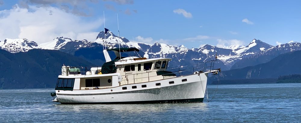
It is only a one hour trip from Boston to Spectacle Island. The fast ferries keep us on our toes for this short trip. The marina at Spectacle Island is brand new with concrete floating docks.
This island is operated by the National Park Service. There is a visitor center just by the marina. The park rangers give tours every few hours.
After nearly fifteen years of environmental cleanup and a cost of more than $170 million, Spectacle Island has been transformed into a 105 acre recreation area. The park was opened in 2006 and includes five miles of walking trails, a marina, and swimming beaches. The island was at one time a smoldering dump and horse rendering facility. The excavated material from Boston’s “Big Dig” was used to transform the eyesore of Spectacle Island into one of the premier island destinations in Boston Harbor.
Over 3.5 million cubic yards of clay, dirt, and dredge were used to cap and fill the landfill. 2400 trees and 26,000 shrubs were then planted on the island. Ferries from Boston bring visitors to the Island each hour. The last ferry leaves for Boston at 6:30 PM and we then have the island completely to ourselves.
The only downside to this island is that no dogs are allowed. The island manager graciously gives us permission to secretly bring Daisy and Sebastian ashore each morning and evening before the park opens. It is disappointing that they can’t explore the island with us. It would be a wonderfully place for them to run.
From the top of Spectacle Island we have an incredible front row seat for up to fifty local fire works displays from all of the neighboring towns of Boston.
The highlight of the evening was the Boston Pop’s fireworks extravaganza. This was probably the best fireworks show that we have seen. To top this off, The Queen Mary 2 pulls out into the harbor during the fireworks. After the finally, she sounds her horn three times as she gracefully slips from the harbor. The view from atop the island is spectacular.
Total Miles Traveled Boston to Spectacle Island: 5
Total Miles Traveled Year to Date: 915
Peddocks Island to Boston Harbor:
We have a short trip of only 10 miles to the inner harbor of Boston from our anchorage. We take our time leaving this morning as we don’t want to arrive at the marina before they open. We leave our anchorage on Peddocks Island at 10:00 AM. Thunderstorms are predicted for this afternoon so we would like to be at the dock before they arrive. I am on the bow washing off the anchor chain as it comes up. When the anchor nears the surface, I see this orange glob just below the water line. I am thinking this is some strange piece of mud. As the anchor comes out of the water, we see a huge metal rusty lobster pot hooked on the tip of the anchor.
We raise it up almost to the bow pulpit and Jeff knocks it off with his foot. It makes a muddy splash into the water and peppers mud over the entire front bow. What a mess.
We wind our way between the Boston Islands back out into Nantaasket Roads Channel. We spot the little yellow ferry which transports visitors between the different harbor islands.
From here we pick up the Presidents Roads Channel which is the main shipping channel into Boston. We keep a keen lookout for the ferries. They caught us off guard yesterday but now we are ready for them. Lobster traps are everywhere in the main shipping channel. We also see many lobster boats out pulling their traps. How are they allowed to put these in this busy waterway? The fast ferry zooms by again at warp speed but we were ready. They give us a really good rocking from their wake with no respect whatsoever for smaller boats. Little tugs are coming and going in every direction. It is a busy harbor. We also have planes landing and taking off from Logan Airport which is just off our starboard side.
At 11:00 AM we see the Coast Guard station on our port side and make a turn into the Charles River. Just ahead is “The USS Constitution”, the world’s oldest commissioned warship.
Immediately past this is the Constitution Marina, our home port for the next week. We VHF the marina and they tell us to come inside to the T-head and dock bow in on our port side. I have to re-rig all of the lines as our standard docking procedure is to dock on the starboard side. Once we enter the marina, we see that there is turning room to turn the boat around for a starboard docking. The dockhands are on the dock waiting to take our lines. They say it is O.K. to spin around and dock starboard. I have to quickly reverse all of the lines for a second time while Jeff spins the boat around in the narrow fairway. At 11:30 AM we are safely tied to the dock and hooked up to shore power.
Constitution Marina is in a wonderful location for exploring Boston. We are located at the base of the Charles River Bridge. The Freedom Trail is just feet from our dock. This is a three mile red-brick walking trail that we take to 16 different historic sites which are all part of the Boston National Historic Park. Bunker Hill is our first stop along this path. A walk across the Charles River Bridge along the Freedom Trail takes us to the Old North Church (oneth by land, twoeth by sea), Faneuil Hall, the Paul Revere House, and the Boston Common.
We enjoy our week in Boston exploring all of these sites. Just across the Charles River Bridge in the North End we find Boston’s Little Italy neighborhood. If you can’t go to Italy, this is the next best thing. The many Italian restaurants and cafes are overwhelming. While walking down a narrow alleyway, we spot Pizzeria Regina. We learn that this is Boston’s original pizzeria operated by four generations of the Polcari family since 1926. The pizza here was fantastic.
While strolling through little Italy, we see practically every other person carrying a little white box. On closer inspection, we see that the box says “Mike’s Pastry”. We follow the crowd upstream until we find its source. There is such a crowd outside that we can’t even see past the front doors. We vow to return later. It takes several trips back before the lines thin enough for us to get inside and place our order. We quickly see why this place is such a hit. With our small white box in hand, we retreat back to the boat in anticipation of a gastronomical delight. The pastries are incredible. Cannolis such as these can only be imagined in your dreams. We are in desert heaven.
While in Boston, we spend one day upgrading our Nobeltec computer navigation program. We had installed several recommended free updates to our version 8.0 several weeks ago. Since that time we have been getting errors while running some of the navigational features. The support staff at Nobeltec was completely baffled as to why this was happening. They graciously offered to upgrade our system to version 10.0 at no charge. We are hesitant to do this as we have to completely delete our current navigational program before reinstalling the new version. It is a little scary wiping out all of our navigational programs from the computer. After spending four hours on the phone with the Nobeltec rep, Matt, we complete the installation. Things went very smoothly and we now have upgrades which would have cost almost $1,000.00 for free. Nobeltec was great and we are happy to have the new version of Nobeltec.
While waundering around Little Italy we come upon Dogfathers, a local dog grooming facility, and decide to let them bathe and groom Daisy. Daisy is a little unsure of where we are taking her. Dogfathers is located on the second floor of an old brick building. We enter the stairwell through a black steel door which takes us up a flight of stairs to another steel door. In the stairwell, there is a big sign on the wall proclaiming “Welcome to Our Family”. We feel like we are ascending into a Mafia stronghold and are unsure of what we will find on the other side of the steel door. Boy what a pleasant surprise. As we open the door, five dogs rush to greet Daisy. All tails are wagging back and forth at the discovery of this new playmate. The owner and several customers cheerfully greet us to this large and well stocked dog store and grooming parlor. Several hours later, we return to find Daisy beautifully washed and groomed.
Total Miles Traveled Peddocks Island to Boston: 11
Total Miles Traveled Year to Date: 910
Provincetown to Peddocks Island, Boston Islands:
Today we had planed on spending the day looking for whales out in Stellwagen Bank. Christen, Steve, Rosie and Josh, my cousins from Chattanooga, were to join us along with their friend Bea. On a boat, your plans always have to be flexible. The winds blew really hard last night and are still gusting this morning. The seas are 3-5 feet out in the ocean. Jeff decides that it is probably best to cancel the whale watching for today. We are very disappointed in not being able to take the group out but didn’t want them to have a bad experience. The boat can certainly handle these seas but it would not be enjoyable for our guest. The forecast for tomorrow is for increased winds and thunderstorms. We decide to make our run to Boston this afternoon. Tomorrow doesn’t look like a good day for traveling across Cape Cod Bay.
We spent the morning walking around Provincetown while waiting on the winds to calm down before leaving.
We found a great Portuguese bakery. Christen, Steve, and Bea join us for breakfast. We enjoy spending some more time with them before heading to Boston. The Pilgrim Monument is located just a few blocks from the main town center. This monument commemorates the “first landing” of the Mayflower Pilgrims in Provincetown on November 21, 1620. It is the tallest all granite structure in the United States. We would like to climb to the top for the fantastic views of the Cape Cod Seashore but will have to save this for another time. The Pilgrims actually landed in Provincetown first before going on to Plymouth.
We pull away from the mooring at 11:30 AM. The wind seems to be calming down some. We listen to the whale sightseeing boats as they spot several whales out in Stellwagen Bank. We wish we were there. It is really disappointing for us that we could not take our relatives out whale watching today. The whale watching boats do say it is a little rough out today so that makes us feel a little better about our decision. As we round Long Point, we start to get 3-4 foot rollers on the bow. It looks like we made the right decision to cancel the whale watching. We reach Race Point which is the very tip of Cape Cod at 12:30. The seas have increased and we have four foot rollers every few seconds. We keep a sharp lookout for both whales and the whale boats. We reach the edge of Stellwagen Bank around 1:30 PM. Around 2:30 the winds die down as do the seas. It is amazing how fast the weather can change. We continue our northern course following the inner edge of Stellwagen in hopes of seeing whales. Just as we turn and head towards Boston Jeff sees some way off in the distance. They are probably a good seven miles from us and it is getting late. We would like to investigate but decide to head on in to the Boston Islands instead. We will have to save the whales for another day. What we do see all day long are deflated balloons floating on the water surface. We have probably ten different sightings of these mylar party balloons.
We enter the Nantasket Roads Channel at about 5:00 PM. The Boston Islands are just ahead. Beyond the islands we can see the Boston Skyline with its towering skyscrapers off in the distance. We soon pass Boston Light marking the entrance to the Boston Islands.
This group of rocky outcroppings seems so strange being this close to Boston. The narrow channel is well marked but you don’t want to stray outside onto the shoals. We near Georges Island and just as we are about to make a turn to port, a fast ferry comes out of nowhere passing us from the rear. Whew!! They almost ran us down. We circle around the small Georges Island in search of a good anchorage. This anchorage is exposed to the prevailing wind direction so we hop over to Peddocks Island to explore the anchorages there, We decide to anchor on the east side just outside of the channel. This anchorage also is somewhat exposed to the winds but it will do for overnight. We have to take into account the 9 ft. tidal range in this area. We are at high tide now so we anchor in 20 feet of water which will only be 11 ft. at low tide.
This anchorage is very rolly. We rock and roll all night long from the many ferries. Many times we just feel the wakes from the ferries but don’t actually see the ferries themselves. There are channels running all around the various islands with many ferries coming and going. These ferries go really really fast.
Total Miles Traveled Provincetown to Peddocks Island: 50
Total Miles Traveled Year to Date: 899
Falmouth to Provincetown, MA 2008:
I just need to quit reading the guide books. Today we must transit the Woods Hole passage. I have worried about this for the last several days. Our guide book says it is one of the most treacherous passages of water along the entire East Coast. Having grown up in this area, Jeff assures me that there is nothing to worry about. We have to time our departure for the currents both at Woods Hole and also the Cape Cod Canal. By leaving at 7:00 AM we will have a 3 knot favorable current going through the Hole and also will arrive at the entrance to the canal with a favorable current. It is critical to have favorable currents at both of these places.
Today we are excited to have company traveling with us. Steve and Josh, my cousins from Chattanooga, are joining us.
Just by chance, they are vacationing in Chattem which is only about 45 miles from Falmouth, and drove down earlier in the week to see the boat. After a short safety briefing with them, we pull away from the docks at 7:00 AM.
There is some low scud out in the harbor and we are hoping that the visibility will improve as we go through Woods Hole. This difficult passage connects Buzzards Bay to Vineyard Sound. Tidal currents here can run up to five knots and you want to have the currents going with you as you pass through the Hole. We pass the Nobska Point Light House at 7:15 and the fog is starting to roll in. Our guide books recommend not going through the Hole in fog. We reach the entrance to the Hole a few minutes later. Even though there is some fog, we still have a reasonable amount of visibility. There are two different fairways which one can take through the Hole. The shorter route is called “Broadway”. We opt for the “Straight” as it is more of a direct path and in this route you are less likely to be pushed off course by the currents and into rocky ledges which are on both sides of the Hole.
As we enter the Hole, things become very confusing to me. There are channel markers everywhere. Which set do we follow? I am glad Jeff knows the route because I am totally confused. We are relying on his memory from 30 years ago. Lets hope it is good. As we near the ferry docks, we make a sharp turn to port through a narrow channel with rock ledges on both sides. Jeff seems to know exactly where he is going. As we reach the middle of the Hole, we see standing waves with a current of almost four knots. Just as quickly as we entered, the Hole has spit us out and we are in the safe waters of Buzzards Bay. What a confusing area! Channel markers were going in every which direction. I am happy to have that behind us.
We see the Cleveland Ledge Light at 8:15 am. This marks the entrance channel to the Cape Cod Canal.
This canal opened in 1914 and is the world’s widest sea-level canal. This seven mile long land cut is 480 feet wide with an average depth of 32 feet. Even though the fog is starting to lift, Jeff decides it best to broadcast a “Security” alert on the VHF announcing our current position and also that we will be heading east through the canal. This alerts others in the area of our position in case of poor visibility. As we enter the canal, Marine Traffic Control calls us on VHF telling us that we must get permission to pass through the canal. We are puzzled by this as our guide book states that only vessels over 65 feet must get permission before entering. Traffic Control then calls back to confirm that we are over 65 feet. We tell him that our boat is only 48 feet long. It turns out that there is another boat named Idyll Time that has transited the canal in the past which is over the 65 foot length and he had mistaken us for that boat. We are glad to hear that we can continue on through the canal. There are several other regulations which must be followed while transiting the canal. Sailboats must be under motor power not sail. The maximum time allowed to transiting the canal is 2 ½ hours. No fishing, anchoring, or turning around is allowed while in the canal.
We enter the canal at 9:00 AM. The fog has lifted and the sun is starting to peek through the clouds. The waterway inside the canal is calm although there is a strong 4 knot current. Tidal swirls push us around a bit in the canal and we must keep a constant hand on the wheel. This current is due to the fact that there is a tidal range conflict between the Cape Cod Bay end (9 ft) and the Buzzards Bay side (4 ft). It seems like no time before we see the eastern end of the canal. We have made in through in just about one hour. At some points we were going almost 13 mph. This doesn’t sound fast for some boats but for us it is flying as we usually average around 9 MPH. We passed no other boats while in the canal.
Just as we exit the canal, the fog returns. We begin to scan the horizon in search for whales as the Cape Cod Bay is a prime Right Whale habitat area. Josh does a great job of being lookout for the whales and also for lobster pots. The bay is glass smooth. It seems like a lake out today with the flat calm water. We are hopeful of spotting whales but see none on our 22 mile transit of the bay to Provincetown. By the time we reach Provincetown, Josh and Sebastian are both sound asleep on the floor all cuddled together.
Sebastian thinks he has died and gone to heaven. He loves having Josh along. We enjoy our time spent with Steve, just catching up on things.
We soon see Provincetown ahead. There is a really bad storm chasing us into port. We listen on the VHF as boaters near the Cape Cod Canal broadcast that they are being blasted with torrential downpours and also lightning. Had we been just a few hours later, we would be in the middle of these storms. As we reach Long Point, we can see the light house and the beaches of the Cape Cod National Seashore.
We make a beeline to the anchorage and are safely moored before the rain arrives.
This afternoon we enjoy a great lunch in town with all of the Chattanooga clan. Rosie then graciously drives us the 45 miles to Chattem so that we can see “Ebola”, the house that they are staying at. What a fantastic beach house it is. There are great views of the Atlantic Ocean from every window. The inside is equally impressive with decorations of many nautical antiques. They truly have a great vacation spot.
Total Miles Traveled Falmouth to Provincetown, MA: 47
Total Miles Traveled Year to Date: 849