Lake Superior is the largest, cleanest, and deepest of the Great Lakes. At 383 miles long and 160 miles wide at its greatest breadth, it has the largest surface area of any fresh water lake on earth. The lake is deep with an average depth of 487 feet and in places almost 1300 feet deep. When measured by volume, it is the third largest lake in the world with three quadrillion gallons of fresh water. Superior could contain the volume of all the other Great Lakes and three more Lake Eries. Lake Superior contains enough water to cover all of North and South America’s land masses with one foot of water. Although it is called a lake, its size qualifies it as an inland sea. It is with trepidation that we venture out in our small boat into this great body of water.
Sault Saint Marie to Batchawana Bay:
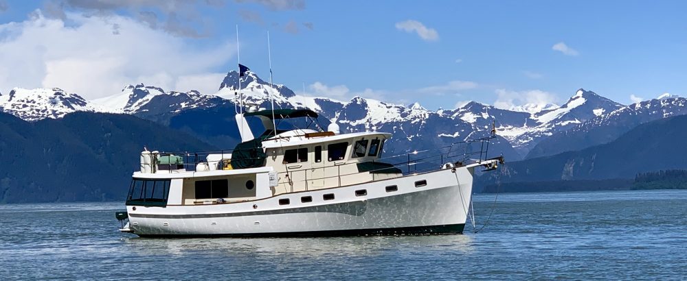
It has been a busy week aboard IT as we prepare for our Lake Superior trip. Our new computer monitor arrived as promised and is now installed.
The generator and main engine fuel filters were changed along with the coolant for the generator. All systems seem to be back to 100 %. Our refrigerator and freezer are again well stocked. Routes are drawn and guide books are studied. We are ready for Superior. Our two week trip will take us along the eastern shore of Lake Superior, the Canadian side.
Our cruising partners, Suzanne and Marty aboard Alizann, arrive to Sault Saint Marie as planned on Saturday.
We enjoy a wonderful dinner with them at Arturo’s Italian Restaurant and discuss our travel plans for the next two weeks. The next morning we are up early to check and double check the weather. The seas are calm with light wind. Superior is a go.
There are two lock systems here on the St. Mary’s River, one on the Canadian side and one on the U.S. side. Most pleasure craft use the smaller Canadian locks while the big Lakers us the huge American Locks. Unfortunately, the Canadian Locks are closed this year for repair and we must use the American Side. As we exit the marina breakwater, we call the Soo lockmaster for transit. We are very fortunate that there are no Lakers in the area and we have no wait for the locks. As the steel doors gently open, we ease IT into the massive 800 foot long MacArthur Lock.
We have an easy 21 foot lift and are soon on our way headed towards Batchawana Bay.
Just after leaving the lock, the skies open up with a tremendous downpour. The fog is rolling in. We are monitoring our AIS for ships and see an 800 foot Laker headed towards us but he is still several miles away.
Just as we are settling in to our cruising routine, our monitor screens flicker. Our first thought is that our monitor is going out on us again. From experience, we have learned that this means lightning is in the area and we have no problem with our screens. A few seconds later, Alizann hails us on the VHF. We can immediately tell by Suzanne’s voice that this is not a pleasure call. Suzanne reports “we are dead in the water; our engine quit and will not restart”. This is not good! While Marty is down in the engine room, we pull alongside to offer assistance. We are in the shipping channel and there is a Laker headed our way. We soon hear their engine crank and are very relieved by the sound. Marty found a tripped breaker which we theorize was tripped by the lightning in the area. Everything is O.K. and we are again good to go. We round a bend to see the freighter just ahead. The shipping channel is plenty wide and we ease over to one side for him to pass.
The Gross Cap Light soon appears as we leave the busy industrial area of Sault Saint Marie and Lake Superior opens up in front of us.
The rain soon disappears and we have a beautiful first day of cruising. The lake is calm with less than one foot seas. We can only hope that we continue to have this good weather for the next two weeks. We soon realize how big Lake Superior actually is. What our charts show as bays and small islands are in fact gigantic bodies of water and land. The high bluffs of the Canadian Shield can be seen rising from the east. Everything seems to be on a grand scale.
It is hard to describe just how massive things are. Our anchorage for the evening is in Batchawana Bay. Like the other bays we saw earlier today, Batchawana is also quite big. We travel almost five miles down this long bay to our anchorage just behind Batchawana Island. Being just an overnight stop, we don’t bother to put the dinghy in the water. Marty and Suzanne come by for drinks before dinner. We celebrate our arrival into Lake Superior with a bottle of Champaign complements of Marty and Suzanne.
Total Miles Traveled Sault Saint Marie to Batchawana Bay: 53
Total Miles Traveled Year to Date: 1032
Batchawana Bay to Michipicoten Island:
Today is another long travel day. We are up at 5:00 AM for a 6:00 AM departure. The weather forecast is favorable. The winds are light and the seas are calm. It is still dark as we pull up anchor and follow Alizann out of the harbor. We leave the protection of land with a northwest heading on our way to the island of Michipicoten. The water depth soon reaches over 700 feet. Our depth sounder can no longer read at these extreme depths. From here on out, we are pretty much on our own. We have no cell phone or internet service. There are no towns or marinas to pull into if we have an emergency. Other than our buddy boat, Alizann, we see no other boats on the water. This area is rarely visited by other boaters because of its remote location. Many boats do not have the self sufficiency to venture this far. We are in the wilderness of Canada. Just a few miles to our west is the site of the Edmond Fitzgerald wreck. Although we won’t travel over the site, it is certainly a reminder of how dangerous this lake can be. It is comforting to be traveling with another boat, especially another Krogen and experienced owners. We are very thankful that Lake Superior is being kind to us today with less than two foot seas.
After several hours of cruising we begin to pick up Michipicoten Island on our radar. At 24 miles away, it is still too far to see with the eye, but the tall hills of the island make for an excellent radar target. As we get within a few miles of the island, the hills loom out of the fog. The ruggedness of the coastline is quite impressive.
We soon see the buoyed channel marking the entrance into Quebec Harbor, the main anchorage area for the island. Michipicoten Island is the second largest island on Lake Superior. In the mid 1800’s there was a copper mine here on the island. The project was eventually abandoned after many millions of dollars were spent without much success at reaching the copper vein. At one time there was also a small commercial fishing operation here in Quebec Harbor. It has since been closed and the buildings are now in disrepair. In 1984 the island became part of Ontario’s Provincial Park System. As we work our way through the harbor, we see a handful of privately owned cottages still remaining on the island.
In the 1970’s caribou were introduced here. The herd is now reportedly quite large. We soon spot one of the resident caribou grazing along the shore. There are no other cruising boats here and we have the anchorage completely to ourselves.
We quickly put the dinghies over for exploration. The caribou we spotted earlier is now lying in the mud so we quickly go over to investigate. He doesn’t seem at all afraid and lets us approach fairly close.
Daisy and Sebastian are fascinated with this new animal. They don’t quite know how to react and fortunately they are both silent. We manage to get some great photos of the caribou. As we dinghy around the shoreline, we see the remains of three wrecks. One is a wooden hull mostly submerged. The second wreck is a steel frame partially out of the water.
All that remains of the third wreck is its boiler and bow plate.
We were told this area offers good fishing for lake trout. We hopefully put our lines in the water but have no luck. The fog soon begins to engulf the harbor and having no radar on Time Out we decide to head back to our boat. This evening Marty and Suzanne come over to our boat for dinner. We enjoy their company while reflecting on our cruise to the island. Today was another wonderful day on the water. After listening to the weather forecast, we all decide that it would be best to move on tomorrow. We had wanted to spend another day here but strong winds are their way. If we don’t leave tomorrow, we may be here for three or four days. Our next destination, Otter Cove, looks even more interesting and would be a better place to stay if we are weathered in.
Total Miles Traveled Batchawana Bay to Michipicoten Island: 89
Total Miles Traveled Year to Date: 1121
Michipicoten Island to Otter Head:
We awoke this morning to thick fog. We can not even see Alizann anchored just in front of us. We decide to delay our departure and let some of the fog burn off. By 8:00 AM, the fog has lifted and we prepare to get underway. Just as we begin pulling up the anchors, the fog rolls back in. We slowly work our way out of the harbor with Alizann in the lead. The fog lifts just enough for us to visually spot the buoyed channel which guides us out the rocky strewn Quebec Harbor. Once out in the lake, the fog returns for the remainder of our trip. We know Alizann is just ahead but our only sightings of her are on our radar. It seems we are the only two boats in this area and we have no other targets to concern us. Just as we reach the north shore of Lake Superior, the fog lifts and we are again rewarded with magnificent views of the rugged shoreline. Otter Head Light perched high on Otter Island soon comes into view.
We slowly work our way around the island cautious of the dangerous rocky shoals lurking just underwater to our anchorage in Otter Cove. It is a beautiful anchorage completely blocked from winds with high bluffs on both sides. The water in the cove is very deep at 40-50 feet until we reach the far eastern end where it shoals up to 20 feet. Here we drop anchor. This is as far north that we will travel this year.
We spend the next two days enjoying the beauty of Otter Cove and exploring the surrounding area. It is one of the most beautiful anchorages that we have been in. We quickly discover that this anchorage is also a great fishing hole.
This is Suzanne’s and Marty’s first fishing experience in the Great Lakes and within minutes Suzanne has landed a monster Northern Pike.
It is no time before she has a second one in the boat. The next day back at the same spot, we latch on to the largest Pike that we have caught this year. We quickly realize that he will not fit into our net. Suzanne and Marty come to the rescue and loan us their fishing net. Without it, I don’t know how we would have gotten this 20 pound three foot fish in the boat.
With our freezers full, we decide to let this big guy go. Within seconds of the pikes release another one has taken our bait. This guy is a real fighter. Each time we get him to the boat he makes another dive for the thick weeds below. We fight him for about 10 minutes and are not making any progress of getting him closer to the boat. This is a big fish. With tired arms, I finally turn the rod over to Jeff and let him muscle the fish up from the weeds. Our fishing rod is bent in the shape of a U as Jeff tries to get this guy up to the boat. All of a sudden I hear a snap and the rod breaks into two pieces. The fish is still on the line so Jeff starts reeling it in by hand. The pike gets to within a few feet of our boat and the line snaps. The fish is gone with our lucky “little Cleo” lure still in his mouth and we now have a broken fishing rod. Enough fishing for today.
While at Otter Cove, we take a dinghy trip five miles down Otter Island to Old Dave’s Harbour. This harbor was named after a fisherman, Big Dave, who in the early 1900’s had a fishing station here on the island. There is not a sole around. The buildings look as if they have not been used for a long time.
Inside the harbor, we also find the assistant light keeper’s house. The house is unlocked and we are able to go inside.
Here we find a notebook in which other cruisers have logged their trip to this remote location. It is interesting to read of the previous boaters here before us. There have been only a few other cruisers here this year. We leave our boat card and enter a note in the log book. Just outside the assistant light keeper’s house, we find a trail which leads across the island to the light house and another home which was the main light keeper’s house. It too is unlocked with a notebook for cruisers to log their trip. Both houses are still in really good shape. We later learned that the keepers were removed in 1988 and the light house is now automated. From the lighthouse we have some magnificent views of the Lake Superior shoreline. This spot could easily be transplanted from the Pacific Northwest. We keep expecting to see Orcas or seals dancing out of the water. On our return trip to the boat, we stop to view Cascade Falls.
We were able to dinghy up to the base of these 60 foot high falls which flow down from the main shoreline into Lake Superior. This evening we enjoy a wonderful dinner aboard the Tuck’s boat. Suzanne served us a gourmet feast of calypso style pork tenderloin with black bean and corn salad all served over a bed of spinach.
Total Miles Traveled Michipicoten to Otter Head: 39
Total Miles Traveled Year to Date: 1160
Otter Head to Brule Harbor:
We start off the day with our daily “Krogen Cruiser’s Net broadcast of Lake Superior” which is delivered each morning by Jeff (AKA Bubba) on channel 71. This has now become a daily ritual in which Jeff updates all the boaters in the area with the news, sports, and weather, of which there is none, before doing the morning check-ins of all boaters in the area. Unlike the Cruisers Net in the North Channel where almost 170 boats call in each morning, we have only two boats to check in. Alizann and Idyll Time seem to be the only “crazy cruisers” in Lake Superior.
Our plan for today was to continue east with some exploration of various anchorages along the way. These areas are so remote and little visited that there is no detailed chart information available for several of these anchorages. We will have to visually keep a lookout for any rocks going into these harbors. Once out into Lake Superior, we get updates on the weather forecast through both the VHF radio and also on our satellite computer program. We have 1-2 foot seas and the winds are forecast to really pick up over the next few days. We quickly realize that going into a strange harbor today would not be a wise decision. We would need good visibility to see the rocks below and today is not that day. We also need to find a good protected harbor for the next few days. After talking with Marty and Suzanne, we all agree that Brule Harbor should be our new destination. This will put us closer to Sault Saint Marie and the harbor offers good protection from all winds. It will be a good place to hunker down for several days if necessary. Although the seas are not flat calm like we have experienced over the past few days, the 1-2 foot chop is easily handled by our Krogens as we work our way down the coastline.
Arriving at Brule Harbor, we find a large beautiful bay protected on all sides by the high mountains. We again find the harbor empty of other cruisers. The bay is very large with room for many boats. Unfortunately it is also very deep with 50-100 foot depths within just a few feet of shore. Anchoring in 50 feet, we would have to let out over 300 feet of anchor chain to maintain a 7-1 ratio. With the rugged shore so close, we would be on the rocks if we let out that much. We find one spot with 40-50 foot depths in a nice protected nitch with a rocky beach shoreline. This looks like our only option but we will have to do a stern tie to shore. We do not have room to swing on the anchor. This is a common technique used when in tight spots so that the boat does not swing. This will be our first time doing a stern tie to shore. We let Alizann go in first and get secure. We then slowly back next to her dropping our anchor in 40 feet of water and slowing backing to within about 30 feet of the beach. Marty then takes our stern line to shore and ties it to a tree. With the beach just behind us we can only drop 90 feet of chain. This is less than a 3-1 ratio and not the needed 5-1 or 7-1. We decide to pull up the anchor and try again by dropping the anchor farther out from shore. As we move out farther from shore, the water quickly goes to 100 feet which is way too deep. We move in until we find 50 feet and drop the anchor for the second time. Backing up from here as far as possible, we manage to get only 150 feet of chain out. We still have only a 3-1 ratio. There is no way that we can get anything better with these depths.
We seem to have a good hook so decided this will have to do. The two boats are side by side with only 30 feet between us and the beach is just a few feet off our stern. With our sterns tied to shore we don’t move an inch.
This evening we take a dinghy trip to explore the smaller inner harbor of this anchorage. There is a narrow 50 foot wide rocky entrance into this little harbor.
We did not feel comfortable bringing the big boats into here without scouting it first. Upon traveling through the entrance several times, we discover a large rock two feet under water just inside the narrow opening. Had we brought our big boats in without scouting the area, we could have easily been on this rock. This little bay is beautiful and even more protected from the winds. Like the outer bay, this anchorage is also very deep and difficult for anchoring. In the shallower spots there are many deadheads lurking underwater waiting to snag our keel. We do find two possible spots to anchor but are still happy that we did not bring the big boats in without scouting the area first.
We have a calm night and both boats do fine in our tight anchorage. However, we still feel uncomfortable with so little chain out and our stern so close to shore. The weather forecast has changed and the winds are forecast to be over 30 knots in a few days. Like us, Alizann also feels uneasy with our current anchorage. We decide to move both boats into the inner harbor. Before doing so, we take the dinghies into this anchorage one more time so that we have it clear in our minds how to negotiate the harbor entrance. After retrieving our shore lines and hoisting the anchor, we cautiously follow Alizann through the narrow opening. Knowing where the rock is, we never saw less than 20 feet on our depth sounder. Alizann has chosen to do another stern tie into the only small but protected cove. We have nicknamed this spot “the garage”.
We choose a deadhead free area just beyond the two foot rock. We find a 35 foot spot that is free of hazards and will allow us to let out 165 feet of chain. We are close to the shore but still have adequate room to swing. Both crews feel very relieved that we moved into this smaller bay.
Brule Harbor ends up being our home for the next week. The weather forecast continues to deteriorate with gale force winds to 40 knots and seas building to 17 feet. These two boats are not going anywhere for quite a while. We are very happy to be tucked into such a beautiful and well protected spot. We could not have found a better place to weather out the storm. Each day we monitor the weather hoping on an improved forecast only to be disappointed. The huge low pressure system over us is not moving eastward at all. We continue to have bands of showers and high winds for the next week. Most days the weather is too nasty to even get outside. We pass the time doing various small boat chores and reading. We take advantage of any weather clearings to kayak around the inner harbor. We also manage to get in several bicycle workouts on the top deck.
It is too rough to even venture past the channel entrance into the outer bay. Each evening we enjoy getting together with Marty and Suzanne for drinks and snacks and occasionally dinner. We alternate our visits between the two boats and enjoy getting to know our friends even better. Brule is wonderful spot but we are all anxious to leave at the first good weather window.
We run our generator for one hour each morning and evening to keep our batteries charged. As standard practice, Jeff went down into the engine room one morning to check everything before starting the generator. He quickly reports “we may have a small problem”. While doing the engine room check he found a puddle of fluid underneath the generator. It seemed to be a mixture of oil and antifreeze. Being in the middle of no where, a small problem suddenly becomes a large problem. Being at anchor, we need the electricity that the generator produces to keep everything running. After more troubleshooting, Jeff decides to call Marty for his opinion. Luckily, Marty and Suzanne had just attended a three day seminar given by the generator manufacturer, Northern Lights. Marty quickly comes over to our boat and he and Jeff discuss possible causes and solutions. They soon determined that water is leaking past the heat exchanger and into the coolant reservoir and causing it to overflow. By a simple tightening of two hose clamps our leak is stopped. Marty had remembered from the seminar a discussion about this exact problem. Thank you Marty for saving the day and our trip!! Things like this remind us of how truly isolated we are. We have decided that if we return to Lake Superior again, we would have a satellite phone onboard for emergencies.
Total Miles Traveled Otter Head to Brule: 59
Total Miles Traveled Year to Date: 1219
Brule Harbor to Sault Saint Marie:
Finally a weather window appears. The winds are less than 10 knots and the seas have calmed down to less than two feet. We are up before dawn getting both boats ready for our departure. It is still pitch dark at 5:15 AM when Jeff takes our dinghy over to Alizann to help them retrieve their shore lines and pull out of “The Garage” where they have been parked for the last week. Both boats then idle in the harbor until it is light enough for us to work our way out the rocky entrance. We have a long day in front of us. It will be a push to reach Sault Saint Marie before dark.
With daylight beginning to appear we ease out of the harbor careful to avoid the two foot rock just under the surface. Jeff marked this rock earlier this week by attaching a plastic floating bottle to the rock. With our flashlights shining on this, we were able to avoid this danger and were soon out into Lake Superior. The raging seas have calmed down significantly and we have a smooth ride back to Sault Saint Marie.
We soon find ourselves leaving the remote wilderness and entering the industrialized area of White Fish Bay along with the fast pace world. We have an easy transit through the Soo Lock and are soon back at Bondar Marina. We enjoy one last meal with the Tucks at Muios, a 70 year old landmark Italian restaurant.
We are now ready to move across the Saint Mary’s River to Sault Ste. Marie, USA. We had arranged almost a month ago for US Fish and Wildlife and the Dept. of Agriculture Vet to inspect the birds so that they would be allowed back in the US. This still seems like such a waste of government money but we are following the laws. They are to arrive at the marina at 7:00 AM. When we set up these appointments, we had called US Customs and asked if we could clear customs the night before at the marina so that we would be sure to be on the docks when the Fish and Wildlife officer arrived at 7:00 AM. The Customs agent checked with his supervisor and said that would be fine for us to arrive the night before but the birds would have to stay quarantined on the boat until checked in by Fish and Wildlife the next morning. Well that is no problem as the birds never leave the boat anyway. As required, we then call Customs three hours before heading across river to the US side of the Soo and gave them our information. We also mention again that the Fish and Wildlife officer will be arriving the next morning to check our two birds into the US. About five minutes after talking with Customs, we get a call back from the Customs agent telling us that we can not come into the US until tomorrow. We don’t argue as it would probably not do any good anyway. Instead we stay one more night in Canada. The next morning we move over to the US before dawn. Shortly thereafter, US Fish and Wildlife and Customs show up to check the birds back into the good old USA. They don’t even bother to go down and look at the birds but just stamp their passports. Dr. Groover, the USDA vet, arrives in the afternoon and fills out his paperwork. It is just crazy what we have to do for our two parrots to come and go from the US. We are now legal to be in the USA and are free to go.
Total Miles Traveled Brule Harbour to Sault Saint Marie: 111
Total Miles Traveled Year to Date: 1330
It has been a while since I’ve logged on to your site. What a treat to read of your adventures on Lake Superior. Margaret and I are so glad that all is going well with the boat and with you. On Tuesday this past week, we held a big party to celebrate caller number 6,000 !!! New record by far. Two more days to go then shut down the Net for another year.
Glad to see at least one of you is exercising on the bike 🙂
Great pictures as always. Wow, nice pike!!!
With love and very best wishes for continued smooth sailing.
Roy