Morehead City to St. Augustine:
Today is a nice day so we decide to head offshore from Morehead City to Wrightsville Beach, avoiding the shallow ICW. It is an easy day run of only 80 miles with good inlets at both ends of the trip. We exit the Beaufort Inlet just south of Cape Lookout. The sun is just rising over the horizon and there are lots of fishermen heading out. We are able to travel just 5 miles offshore down the coast. The seas are calm and it is almost like a lake out in the ocean. We briefly consider running overnight down to Charleston. The weather forecast is good but we would be going across the shoals of Cape Fear after dark. Never having traveled that area, we take the safe route and head into the Masonboro Inlet at Wrightsville Beach for the night. From here we will take the ICW on the inside of Cape Fear. They don’t call it Cape Fear for nothing. Many a boat has met its demise on the Frying Pan Shoals, some of the most treacherous along the Atlantic. Cape Fear has earned the nickname “Graveyard of the Atlantic”. We anchor just behind Wrightsville Beach and enjoy a nice sunset.
We aren’t putting the dinghy down to take the dogs ashore so we will see how they do with their turf on the bow. It could be a long night for them.
The dogs finally gave in the next morning and reluctantly used their turf mat just before we pulled up the anchor. From Wrightsville Beach we travel the ICW through Snows Cut and the Cape Fear River on our way to Myrtle Beach. This section has three major problem areas to contend with. Carolina Beach Inlet, Lockwoods Folly Inlet, and Shallotte Inlet are three of the nine major areas of shoaling along the ICW. The ICW crosses these inlets just yards from the Atlantic Ocean side. The Army Corps of Engineers are constantly adjusting the navigation markers in this area. Funding for dredging the ICW has been a low priority for Congress and these areas are now places where boaters constantly run aground. We time our trip to arrive at these inlets at high tide. It is a tense day down this stretch of the ICW. We manage to make it across all three inlets without touching bottom. Our depth sounder alarm goes off showing only 6 feet while crossing two of these inlets. We are at high tide. There is no way we could have traveled this area at low tide. There is a sigh of relief once across. I hate the North Carolina ICW! We next have about a 30 minute wait for the Sunset Beach Pontoon Bridge.
This is the last operating pontoon bridge along the Atlantic ICW.
Soon past this bridge, we cross the border and are now traveling in South Carolina waters. We see many large southern antebellum homes with their long wooden walkways extending over the marsh to the ICW banks.
We next enter a 28 mile man-made land cut called the Pine Island Cut. Within this section is a five mile area called the “Rock Pile”.
Here the channel narrows significantly with rock ledges lining both sides. As we enter this cut we give a “securite” call on the VHF notifying our position and alerting any traffic coming the other way. It would be very difficult to pass a large vessel in this cut. No one answers so we proceed. Just our luck, about half way through this cut we see a sailboat rounding the bend heading our way. We edge over slightly as we pass. Once through this cut, we see our marina, Barefoot Landing, just ahead. This marina is located right along the ICW. Here we find over 100 outlet stores and many restaurants just behind our docks. The dogs are happy to be ashore as they have now been onboard for about 32 hours. We have a nice dinner at Joe’s Crab Shack.
The next morning we leave Myrtle Beach and continue through the Pine Island Cut. This area is certainly not what you would call a natural scenic river. It is all man made with glitzy houses and condos one after another.
We even travel under a cable car which transports golfers from one side of the cut to the other.
We soon reach the Waccamaw River and our scenery changes dramatically. Both river banks are lined with moss covered cypress trees. There is no development along this stretch and we have a very enjoyable transit.
We bypass Bucksport Marina today as we are pushing to get as far as possible. We stopped here on our way north last year for some of their award winning homemade sausage. Jeff wants to stop again but we are against the clock.
As we near Georgetown, we once again check the weather forecast. The Winyah Bay Inlet is about 12 miles further down the waterway. It is now decision time for us. Here we either continue down the ICW or exit the inlet and make an overnight passage out in the Atlantic. The weather looks good so we decide to go for it. This will be our first overnight passage with just the two of us aboard. We exit the Winyah Bay Inlet at 2:30 PM. At this point we are not sure how far south we will be able to travel. There are several navigable inlets which we can enter tomorrow. We will travel as far south as daylight permits.
Once out in the ocean, we have two foot following seas. It looks like we will have a nice overnight passage. We had prepared some beef burgundy in anticipation of our overnight trip and enjoy that for dinner along with pasta. At 8:30 PM we approach the Charleston Ship Channel and things get busy. We have many container ships traveling both in and out of the Charleston Harbor. Our AIS system continually monitors these targets and gives us our closest point of approach. The “Sierra Nevada Hwy” ship is traveling out of the harbor just in front us. From the AIS, we learn that this ship is bound for Bremerhaven, Germany. It is a 900 foot long container ship with a 102 foot beam and should arrive in Germany 11 days from now at 9:00 AM. We stay well clear of him. Once past Charleston, our radar screen is blank and we settle in to our watch rotations. The half moon is shining brightly from the sky and provides some light for us to see any objects floating in the water. Around midnight things get busy once again as we cross the Savannah entrance channel. The many container Ships waiting to enter the harbor light up the night sky. Once past this busy area, things remain quite for the remainder of the evening. The clouds return and we are in total darkness with only the radar and electronic charts to guide us. Daisy and Sebastian are all curled up in the pilot house with us and they sleep through the night. The night goes quickly and we soon see the sun rising from the horizon. It is nice to be able to once again see what is in front of us. We next bypass the St. Simon’s and St. Mary’s inlets in hopes of making it to St. Augustine before dark. We are so close yet so far away. We would arrive to the St. Augustine Inlet just 30 minutes after dark. If only we had another hour of daylight we would be able to make it. We opt for the safer route and head into the St. John’s River Inlet. This is a major shipping channel that leads to Jacksonville. There are many shrimp boats plying the waters just at the entrance to this inlet.
The inlet is wide, deep, and well marked which makes for a safe and easy passage. Three dolphins ride our bow wake as we enter the inlet and escort us up the St. John’s River.
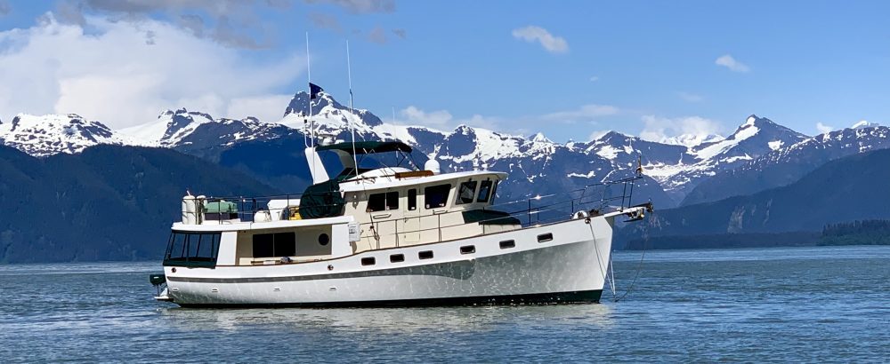
We soon enter the Pablo Creek to our port. We are now back on the ICW. Just a few miles up this waterway is our marina for the night, Beach Marine. IT has traveled 320 miles with a total travel time of 34 hours with no problems what so ever. Daisy and Sebastian did great and we treat them to a long deserving walk ashore. Nate and Homer were also well behaved and we treat them to extra time out of their cages visiting with each other.
We are both tired but happy to have been able to make this offshore passage bypassing many shallow areas along the ICW in Georgia. We saved around five days of travel time by running outside.
After a good nights sleep, we continued the next morning down the ICW to St. Augustine, 30 miles south. We feel fortunate to have had the good weather over the past few days for our outside run. Today it is windy and the forecast is the same for the next five days. There would be no ocean passages for at least another week. The Georgia portion of the ICW has many shoaling areas, and we are happy to have avoided them completely. The dolphins once again join IT riding our bow wake and escort us almost all the way to St. Augustine. The dolphins here in the south are much friendlier than those up north. While in Maine, we saw many dolphins also but none would ever join us. As soon as we crossed over into Florida, almost every dolphin we have seen joins us for a ride along our bow.
Sebastian is especially happy to be in Florida where it is warm and sunny. He looks forward to spending lazy days on the front deck working on his tan.
Daisy and Sebastian both anticipate many walks to visit Grandma and Grandpa (Jeff’s parents). IT will spend the next two months in her berth at the Conch House Marina patiently waiting for us to once again cast off the lines and begin new adventures.
We will resume our cruising south including the Bahamas in February.
Total Miles Traveled Morehead City to St. Augustine: 498
Total Miles Traveled Year to Date: 3172
Great Bridge,VA to Morehead City, NC :
While preparing IT for our trip south, we monitor the weather for the next few days. Our plan was to spend a few days here in Great Bridge getting everything organized for our trip before shoving off. The forecast continued to deteriorate in the coming days. We quickly realize that if we do not make it across Albemarle Sound tomorrow, 70 miles to our south, we will be waiting four to five days. We make a quick decision to leave NOW! It is already 1:00 PM and darkness arrives at 5:30 PM. Although we will not be able to do many miles today, we can get through the two bridges just below us and to an anchorage about 20 miles from here. The bridges do not open in the mornings until after 8:30 AM so by getting through these now, we should be able to make it across Albemarle Sound tomorrow.
Jason, the dock master, comes by to help with our lines. IT is wedged between two large boats and Jeff does a great job of getting out of this tight spot. We are on our way at 2:00 PM. We make the 2:30 Centerville Bridge opening with just minutes to spare. We rush as fast as possible down the canal to reach the North Landing Bridge opening at 2:30. This bridge is five miles away and we arrive two minutes late. The bridge operator knew that we were coming as the Centerville Bridge tender radioed ahead. Luckily, he delayed the opening a few minutes for us. That was very nice of him. We are now traveling in the Albemarle Chesapeake Canal. This area is very remote with Cypress trees lining both banks.
We see just one other boater on the water. Just outside the narrow channel, we see many tree stumps poking above the water. We must be careful for the floating deadheads along this section. We are soon in the North Landing River. This area is part of a Natural Area Preserve and is very scenic. Marshes line both banks.
While chatting with a local boater at the Centerville Bridge, we learned of a possible free dock space for the night. We had told him that we planned on anchoring somewhere around the Pungo River Bridge. He said that the Pungo Ferry Marina was closed and that we could tie up for the night at their face dock if no one was there. We arrive here to find the place all boarded up.
No boats are here. Not sure of the depths, we cautiously approach the docks and tie up. Not a soul is around. There is however, a No Trespassing sign posted on the front door of the building. The dogs are thankful for the opportunity to go ashore. Let’s hope no one shows up and ask us to leave.
We are up before dawn for our next leg of the trip across the Albemarle Sound. Luckily, no one showed up during the night to kick us off the dock. We have the engines running at 5:30 AM. At 6:00 it is still dark but we decide to ease down the river until daylight. We cautiously go from marker to marker until daylight arrives. We are anxious to get across the 15 mile Albemarle Sound passage. Just on the other side of Albemarle Sound we will be traveling through one of the major problem spots along the ICW. This area is prone to shoaling and several boats have already run aground here this fall. We also touched bottom last time through this area. We are dreading this part of the trip and will be happy to have it behind us.
Just as the sun peeks above the horizon, we cross the Virginia border and are now traveling in North Carolina waters. We have an easy transit of the Curturk Sound and are soon passing by Coinjock in the North Carolina Cut. From there we take the North River to the Albemarle Sound. The seas are not too bad for this area and we are soon across this sound and entering the Alligator River. We carefully check and re-check our instructions for passing through this shoal prone area. We slowly go from marker to marker constantly watching our depth finders. After several tense minutes, we see the Alligator River Swing Bridge up ahead.
We are relieved to have safely passed through this area without touching bottom. Our depth finders never showed less than 11 feet. We decide to bypass our two anchorages and continue on to Dowery Creek Marina in Belhaven. If lucky, we should make it just at dark.
We see very few boats on the water and have an easy passage along the Alligator River to the Pungo River Canal.
This area is very remote with swamp and marsh on both sides. As we reach the canal end and enter the Pungo River, darkness is approaching. By the time we make our turn for Dowry Creek it is pitch black outside. Luckily it is a straight forward approach into the marina. We follow the marina markers one by one. Once we see a marker we scan the waterway with the remote spotlight for the next marker. The bright green and red reflectors on the channel markers shine in the spotlight. After marker 12 we spot the marina docks. The dock master knew we were coming and is staying late for us. He shines his flashlight on the dock for us to see. The one advantage of arriving this late is that they put us on the fuel dock which is an easy side tie. It would have been tough docking in one of the slips in the dark and with this wind. After a long day of 105 miles we are safely at dock. The dogs, after holding it all day, race to shore.
The next morning we again have the engine running before daylight. There are some strong winds forecast for this afternoon so we would like to get an early start for Beaufort, NC. It looks like we have brought the fog with us from Maine. We can barely see the first channel marker a few feet from the boat. We feel our way out the channel hoping the fog will lift once we get to the Pungo River. Out in the river, we are still completely socked in. We slowly continue while constantly monitoring our radar. After several tense hours we reach the Neuse River still enveloped in fog and now rain. This river has a reputation to get pretty nasty when the winds are blowing hard. It is the widest mouth river in the U.S. and is very shallow. Today the water is relatively calm. The Coast Guard radios an alert for some severe thunderstorms in our area and says all boaters should seek shelter. We can barely see just feet in front of us. Thank goodness we have radar. We soon see a target up ahead on the radar. We scan the horizon as we approach it. A sailboat appears out of the fog just ahead and we radio him of our position. He doesn’t respond. At the same time, we hear another boater ahead of us radio and say a big barge just passed him. A big target appears a few seconds later on our radar screen. It is the barge and he is rapidly approaching on our port side. The sailboat, on our starboard side, still has not responded to our calls. We slow to a crawl and give a blast on our horn trying to alert the sailboat. The barge sees us on his radar and gives a position call on his VHF. We respond and tell him our position. He notifies us that he has now stopped to let the traffic pass. He soon comes into view on our port. Just as we pass the barge, the sailboat finally answers our call. Once past these two targets, our radar screen is again clean. It seems that everything always happens all at once. The storms are approaching and our electronics flicker on and off several times due to lightning in the area. We would really like to turn off our electronics but there is no way we could possibly navigate in this fog without the radar. The situation is not good. After checking our charts, we see that Broad Creek, with a nice anchorage and marina, is just a few miles away. We decide to duck in there until these storms pass. We enter Broad Creek with zero visibility going from marker to marker careful not to venture outside the channel as it shallows just feet on each side. We hold up here for about 30 minutes trying to decide what to do. We see more storms approaching on the radar and the fog is dense. It has been a tense 5 hours and I am ready to call it a day. After a quick call to River Dunes Marina, we are safely tied to their docks for the night.
Maybe things happen for a reason. River Dunes is a pleasant surprise and a great find. Several other cruisers had stopped here on their way south and it was highly recommended. We would have to agree. This planned waterfront community of coastal homes is currently under construction. Eventually there will be over 600 homes on the 1300 acres of property along with several restaurants and other business establishments. Only about 13 homes have been built so far but the ones here are very impressive.
The marina here is first class and will eventually have over 400 slips. We are the only boaters here and have full run of their facilities which includes a nice exercise room, a great bonus.
We spend the afternoon enjoying a tour of the facilities with their real estate agent, Richard. The poor economy has certainly slowed this development but no doubt it will someday be a world class boating community. Poor Sebastian did not have as good a time at River Dunes. While out for a walk, he decided to roll is something REALLY NASTY. After being out of our sight for just a second, he was covered head to toe in muck.
What was he thinking? He is usually our clean fanatic and Daisy is the one that likes to get dirty. Needless to say, Dad quickly reprimanded Sebastian and hurt his feelings. He next got a bath on the back swim platform. He was not a happy camper!
From River Dunes, we had a short day on the water to Morehead City. It is raining, cold, and very windy but at least we can now see where we are going. Once docked, we take the dogs for a short walk into town. Almost all the restaurants and stores are closed down for the winter season. Our marina, Morehead City Yacht Basin, is located just a few miles from the Beaufort Inlet. We hope for good weather tomorrow so that we can make an outside run in the Atlantic Ocean down to Wrightsville Beach. The ICW has several shoal areas and bridges to contend with on the next section. By running outside we will be able to avoid all of those problems. Right now the weather looks favorable for an outside run but we will make the final decision in the morning just before leaving.
Total Miles Traveled Great Bridge to Morehead City: 200
Total Miles Traveled Year to Date: 2674
Great Bridge, VA:
After six months of cruising along the coast of Maine, Idyll Time is once again resting safely alongside the long face dock at Atlantic Yacht Basin. This place almost seems like home as IT spent the winter here last year. It is a fascinating marina located just feet from the Intracoastal Waterway (ICW). We have a front row seat as all of the boats heading south for the winter must pass right by our boat. Each hour like clockwork, we hear the horn blow signaling that the bridge just north of us is opening.
We watch as the boats crowd through the lock and bridge with each opening. This is one of the busiest times of the year as everyone is now going south for the winter. Over 15,000 boats pass through this area each year as they migrate both south and north. The marina even has several old wooden lawn chairs along the docks so that boaters can sit and watch as the boats go by. You see all kinds of boats both large and small. We were amazed to even see the cruise ship “American Spirit” appear one day as the bridge opened.
How she is able to navigate this narrow and shallow part of the ICW is beyond me. The docks at Atlantic Yacht Basin are chock full of boats stored here for the winter. There is not a space to spare. “Scout” which used to be the Presidential Yacht is tied up just a few slips down from IT. Although no longer the Presidential Yacht, “Scout” is owned by a non profit organization, and we understand that the President and former Presidents still charter her for special occasions. This grand old boat is immaculate.
IT patiently waits along the face dock while we spend several weeks at our home in Chattanooga, TN. Once back aboard, we fill the tanks with fuel in preparation for our trip south. Who would have ever though that we would now be paying only $2.35 for diesel fuel? This is half the price that we paid just a few months ago in Maine. After a quick to the grocery store, IT is once again ready to cruise. We will now join the thousands of other boaters heading south. There should not be too much boat traffic for us as most boaters started migrating several weeks ago and are well south of us by now. Sebastian wonders why we did not leave earlier also as it is really cold here. All bundled up in his blanket, he ask us to please get to Florida soon!