Mill Lake to Killarney:
From Mill Lake we have another beautiful day for our 18 miles of travel to the town of Killarney. The LaCloche Mountains are just a few miles away, and we can see the jagged rocky quartz boulders along the mountain tops.
The water is now an aqua blue color just like the Caribbean. It is so clear we can see the rocky bottom twenty feet below us.
The East Lighthouse marks our entrance into the narrow passageway of Killarney.
The Indian name for Killarney is “Safe Canoe Passage”. This two mile narrow cut between the mainland and George Island is home to this thriving fishing village. Everything is centered along the waterfront. The Pittfield General Store and the LBCO (liquor store) even have docks for boats to stop at for a quick purchase.
Killarney was established in 1820 as a fur trading outpost and is the oldest community in the North Channel. No road access was established here until 1962. The majority of Killarney’s 500 residents are descents of its original settlers.
We continue two miles outside of town to Covered Portage Cove which is our anchorage for the evening. This well protected cove is one of the most famous anchorages in the North Channel and we are pleasantly surprised to find few boats here and plenty of room to anchor.
The high rocky bluffs surrounding the cove are amazing. We hike with the dogs to the top and are rewarded with a grand view of both the inner and outer harbors.
This evening we dinghy the two miles back into Killarney for some fish and chips at the famous “Herbert’s Fisheries”. This take away is housed in an old red school buss. Their locally caught Perch are really good. People come from miles to eat here and by the time we left there was a very long line waiting to order. We stop for some homemade ice cream next door before returning to the boat.
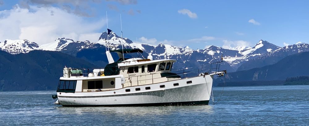
The next morning we move IT three miles back to the village of Killarney. We have an enjoyable two night stay at the Killarney Mountain Lodge. This rustic mountain lodge was built in the 1920’s by the Fruehauf trucking corporation as a retreat for the company employees. It was purchased in the 60’s by Mr. East and has been operated as a lodge since that time. This unique lodge has not changed much since then and retains much of its charm and character.
As a guest at the marina, we have full use of all the lodge facilities. There is a heated outdoor pool, game room, restaurant, and unique lounge. We enjoy a great dinner here our first evening.
Killarney is a really neat little town. It is more like a boating and hiking outpost than a town. There is one main street with a general store, LBCO (liquor store), two marinas, and two lodges, along with the famous “Herbert’s Fisheries”. Of course there is also a great ice cream store. Canadians’ certainly like their ice cream. Just outside of town is the Killarney Provincial Park headquarters. We decide to ride our bikes the 10 miles to check out the hiking in the park. There is only one long straight road which goes out of town connecting Killarney to the rest of the world. We were hoping to see a bear as they are frequently sighted in the area but never did. The provincial park was completely full of campers. There are many hiking trails and a big lake for canoeing here.
We manage to do two good hikes while in Killarney. We first hiked four miles out to the lighthouse with Daisy and Sebastian.
This lighthouse has an automatic fog horn which boaters can activate by keying their VHF microphone five times. The dogs really enjoyed the exercise and arrived back to the boat very tired. Our second hike was on George Island just across the waterway from our marina. This five mile loop hike took us over some very rugged terrain. I have to say the hiking trails here are not anything like those we are used to. It is more like bushwhacking than hiking.
The mosquitoes are horrendous. While hiking, we kept a sharp lookout for bears. Jeff had his “bear banger” ready just in case. We purchased this new piece of hiking equipment while in a camping store in Parry Sound. This device looks like a pen and you load an explosive cartridge on its tip. When activated, it will shoot the cartridge at the bear exploding above him and making a loud bang. We did keep a bear spray aboard the boat but had to ship it home just before entering Canada. It is illegal to carry pepper spray across the boarder. However, we later learned that “Bear Spray” is legal as long as it is properly marked. Next year we will bring it back with us. A few miles on the trail, we spot some very fresh bear scat. It was still warm. Several miles later as I am picking wild blueberries, I hear Jeff say something. I look up and he is pointing into the woods. He just saw a black bear disappear over a rocky incline. I guess it was eating the blueberries also. Several other bears have been sighted around our marina in the last few days. The bears are in the area.
Before leaving Killarney, we headed back to Herbert’s Fisheries for one last fish and chips meal. This place certainly does the business. We arrived before the crowds and still had a 45 minute wait for our dinner. The fish is very good and well worth the wait. This evening the marina managers, Rick and Evelyn, stopped by the boat for a drink. We enjoyed chatting with them and learning more about the area. They hope to be cruising on their boat next year and we hope to catch up with them again. After being at a marina for two days we are ready to find a nice peaceful anchorage.
Total Miles Traveled Mill Lake to Killarney: 18
Total Miles Traveled Year to Date: 2633
The Bustard Islands to Beaverstone Bay:
It looks like our prayers have been answered for good weather. This is the third day in a row with sun and no winds. Summer seems to have finally arrived! As we make our way past the Bustard Rocks, we can see that Georgian Bay is flat calm today. We have a 15 mile passage down the lake to Beaverstone Bay. The LaCloche Mountains provide a stark contrast to the clear blue skies and dark waters.
Our entrance to Beaverstone Bay is littered with shoals and our guide book warns that it should only be attempted in good weather. We feel fortunate to have had two good days for our open water passages.
Once inside Beaverstone Bay, we again wind our way around the many rocky islands. The shoreline is becoming steeper with high granite cliffs.
We soon reach the narrow buoyed channel at the entrance of Collins Inlet. In years where Georgian Bay water levels are at chart datum level, this ¼ mile section has less than five feet of water and deep draft vessels must take the open water route to Killarney. Lake levels this year are about 1 ½ foot above Chart Datum. The bottom is mud, not rock, so we are willing to give this a try. Our depth alarm constantly sounds but we never see less than 5 ½ feet on the sounder.
After traveling the Trent Severn, this doesn’t even faze us. Once through this shallow section, we make a sharp port turn and enter the splendid gorge of Collins Inlet.
This long narrow gorge is deep with 50 foot high rock walls disappearing straight down into the water. Halfway through the gorge, we turn into Mill Lake. This three mile long lake has many islands and nice anchorage possibilities. We tuck in behind Green Island for the evening.
Two other Loopers arrive here this evening. We briefly talk with the family on a little grey trawler, Pearl, and learn that they are from New Zealand.
They and their two children purchased their boat last year in Florida and are now doing the loop before heading back to New Zeeland. The kids are home schooled and seem to be having a great time.
We enjoy two lovely days in Mill Lake. This remote area offers stunning beauty and solitude. Other than the few boats at anchor, there is absolutely nothing other than beautiful scenery and water. It is amazingly quiet! We do feel a little isolated. Even our cell phone and wireless internet will not work here. There are only three cottages along the entire lake. We have fallen in love with one little log cabin with its green tin roof, and it is for sale. Oh no! Jeff is thinking if we owned this cabin we for sure would need a sea plane!!!
We try our luck at fishing and manage to catch a nice bass for dinner.
I caught (well almost) a really nice three foot pike. As Jeff grabbed the line to bring him into the boat, the fish made one last heroic flip of his tail and snapped the line. We lost not only the fish but also our lucky lure which is still in his mouth. This is the lure which we have caught almost all our fish with and we don’t have another one. It was really disappointing to loose both the nice fish and our good lure. Oh well! We did catch several other small pike and bass but decided to let them live another day. Mill Lake is a truly special place.
Total Miles Traveled Bustards to Beaverstone Bay: 28
Total Miles Traveled Year to Date: 2615
Hopewell Bay to The Bustard Islands:
The forecast for today is light winds and sun. It should be a great day for cruising. Just as we begin to raise the anchor, the fog starts to roll in. By the time we exit our anchorage, we find ourselves completely socked in. We must now rely only on the computer screen and radar to navigate around the rocky channel. Our VHF radio has a feature where we can broadcast our position in the fog. Jeff activates it to automatically sound one long whistle every two minutes, as this is the signal for vessels underway in fog.
As we near Champlain Island, the fog begins to lift. We can now see the many cottages along this section of our route. At one turn, our green channel marker marks a shipwreck. The marker is sitting on top of the ship’s boiler which is sticking four feet out of the water.
Today we are exiting the Small Craft Route at Pointe au Baril Inlet. This is one of only five easy to navigate channels with a safe passageway from the Small Craft Route to the deep waters of Georgian Bay. A picturesque 1889 lighthouse marks the entrance to this inlet.
The lighthouse is now a museum open to the public. Next to the lighthouse is a wooden barrel perched above the rocks. Before the lighthouse was built, a lantern was placed on top of a barrel on a pole at this site to guide ships into this safe passageway from the open waters of Lake Huron. Hence the inlets name, Pointe au Baril, which translates as barrel point.
From the Pointe au Baril Inlet, we have a 30 mile open water run to the Bustard Islands. One could continue inside on the Small Craft Route through the Hangdog Chanel. We were advised that the inside route for this section is very narrow with lots of shoals. A boat sank here last year trying to navigate the difficult waters. We decide it much wiser to run outside for this section. The weather is good today and we have an easy trip across the bay with light winds. The LaCloche Mountain range is now visible on the horizon.
Consisting of quartz, these mountains appear to be snow covered.
We soon see three light houses marking the Bustard Rocks.
There are many shoals south and east of the Bustard Islands. We carefully follow the Gun Barrel Channel which leads us into one of two anchorage areas. We find a nice spot to drop the hook for the evening. This area is known for its pickerel fishing. We try our luck in hopes of catching dinner. No fish are to be found.
Total Miles Traveled Hopewell Bay to the Bustard Islands: 45
Total Miles Traveled Year to Date: 2587
Parry to Hopewell Bay:
We are delayed in leaving this morning due to fog. The harbor is completely socked in with almost zero visibility. The rain and winds have passed so it should be a nice day once this lifts.
We spend the morning making phone calls to the various government agencies regarding bringing our two birds back into the United States.
We began this process just after entering Canada. At the time, everything seemed to be falling in place smoothly. We first have to clear the birds out of Canada with Canadian Customs. The bird’s CITIES passports must be stamped by a Canadian Customs officer. We then have to clear US Customs and US Fish and Wildlife has to inspect the birds. After several phone calls, it was decided to clear in Sault St. Marie. Although this is about 100 miles out of our way, it seemed to be the logical location. Sault St. Marie has both a Canada and US side so Customs would not be a problem for either Canada or the US. The US Fish and Wildlife officer can also travel to Sault St. Marie at no charge. In addition to all of this, the birds must be inspected by a US Dept. of Agriculture vet upon their arrival in the US. The Fish and Wildlife officer said that this too could be done in Sault St. Marie. It all seemed pretty easy. Well, not exactly! We call the vet to set up an appointment and learn that he is on medical leave and his secretary does not know when he will be back. USDA then tells us that we will have to clear customs in Port Huron. This is 500 miles from our cruising area in the North Channel. They don’t seem to understand that traveling by boat is not like getting in a car and just driving somewhere. After several more calls to USDA, they agree to have another vet travel to Sault St. Marie. However the closest vet is in Lansing, Michigan which is a three hour drive each way. We would have to pay for the vet’s expenses to travel to Sault St. Marie at $125.00 per hour. We are now talking about $700-$800 just for the vet’s travel expense. In addition to all the other permits, we also need a USDA permit because the birds are entering at an “Ocean Port”. This permit is another $125.00. So, today we have been making more phone calls to USDA trying to come up with a better solution. We finally talked with Dr. Cooper at USDA headquarters in Maryland. She is the first person we have talked with who seems to understand our situation. Several phone calls later, USDA has agreed to let us clear customs in Sault St. Marie and then wait until we reach Grand Haven, Michigan to clear the birds. The birds must be quarantined aboard our boat until we get down to Grand Haven. This is no big deal as they haven’t left the boat since arriving in Canada anyway. USDA will then send someone from Lansing, Michigan over to the boat and inspect the birds. We will still have to pay for the Vet’s travel expense but it will be a much shorter trip. Since we no longer need a vet in Sault St. Marie, we call Fish and Wildlife to see if we can clear with them in Drummond Island. Customs is here and most boaters clear in Drummond instead of traveling the extra 120 miles out of the way up to Sault St. Marie. It would be much closer for the Fish and Wildlife officer also. Well, after checking with her supervisor she tells us that she can go to Drummond Island but that we would have to pay her travel expenses. If she travels even father up to Sault St. Marie, we do not have to pay the expense. It makes no sense but we will go to Sault St. Marie. What we go through for our animals!
The fog finally lifts and we have an enjoyable cruise to our next anchorage. Navigation for this section of the Small Boat Channel is relatively easy. There is one section called Canoe Channel which is only suitable for boats under 40 feet. We elect to bypass this and head outside for several miles before rejoining the route. Our anchorage for this evening is in Hopewell Bay on the island of Shanawaga. This island is part of public land and no cottages are built here. It is a nice large bay and five other boats anchor here for the evening also.
Sebastian pesters Dad all afternoon to put his boat (our dinghy) in the water. He wants to go fishing. Jeff finally gives in this evening and we go for an enjoyable cruise around the bay. Sebastian is fascinated by this fishing thing. He is beside himself when we catch another nice Small Mouth Bass.
He can hardly keep his head out of the fishing bucket.
Back at the boat, he has to closely supervise the fish cleaning process.
Afterwards, Sebastian decides to goes back out to the dinghy to check for more fish. We hear a big splash. Sebastian has fallen into the water. He immediately tries to swim under the boat and pays no attention to our calls. After a few seconds of yelling and screaming, Jeff manages to yank him by the neck and hoist him back aboard the boat. Poor little guy! Fortunately the water is warm. After being dried off with a towel, he is right back out on the swim platform looking for more fish. We enjoy another quiet evening at anchor.
Total Miles Traveled Parry to Hopewell Bay: 29
Total Miles Traveled Year to Date: 2542
Huckleberry Island to Parry:
We have only a short trip across Parry Sound to Big Sound Marina in the town of Parry. Storms and high winds are forecast for the next two days so we decide to take cover at the marina. The town dock is home to Canada’s largest sightseeing cruise boat, The Island Queen. She is on her way out of the bay as we are heading to our marina.
Parry is also home to a local air service, Georgian Bay Airways. We navigate around several sea planes as they are coming in for a landing. Their runway is literally right in front of our slip at the marina. We watch as these sea planes take off every few minutes to remote destinations all around the Thirty Thousand Islands. Jeff has now decided to move here and become a sea plane pilot. I agree to that as long as we can have a cottage here also.
Our marina is a constant beehive of activity with boats coming and going. Big Sound Marina is run by the town of Parry for transient boaters. There are about 200 slips here which are all transients, but mostly boats from surrounding local areas. There are lots of pets on the dock. Many of the other boats have dogs aboard.
The sailboat across from us has a cat aboard.
Nate and Homer, our two parrots, come out on their T-stand every evening in our salon. They catch the attention of the other boaters walking the docks. Everyone stops and wants to know about them. As a side note, we are still dealing with US Customs, Fish and Wildlife, and USDA about bringing the birds back into the U.S. What should be a simple process is becoming more bizarre every day. We will save that story for another log!
The town of Parry is a 10 minute walk from the docks.
The town is small but very vibrant. There is a sidewalk sale the day we arrive. This area seems to be the hub of activity for the many “cottagers” from the surrounding islands. The local grocery store, Sobeys, offers a free shuttle service from the marina. This is a wonderful service for boaters and many people stop at the marina just to take advantage of this free transportation. We will not have a major grocery store once we leave this area so we take advantage of the shuttle to reprovision our stores aboard IT.
Fellow looper, Tucandu, stops here also. We spend the morning going over our charts with them as they missed the Looper Rendezvous in Penetang. This afternoon we find a nice hiking/fitness trail which we follow for several miles. The trail takes us to a fire tower which we climb to get great views of the sound. The dogs really enjoy the hike.
Squall warnings are forecast for this evening with winds up to 50 MPH. We are glad we stayed here for another night. Tomorrow we hope to find a nice anchorage along our route to Killarney.
Total Miles Traveled Huckleberry Island to Parry Sound: 7
Total Miles Traveled Year to Date: 2513
Port Rawson Bay to Parry Sound:
We could easily spend several weeks anchored in Port Rawson Bay but there are other places to see so we decide to take advantage of the good weather today and push on. It looks like we will be fortunate enough to see the sun today. It is still very cool here with lows in the low 50’s at night. We feel lucky in the rare instances that the sun comes out and warms things up to a high 70 degrees (this is August).
Our destination today is an anchorage in Parry Sound. After retracing our steps out the narrow channels of Port Rawson, we rejoin the “Small Craft Route” at Henry’s Fish Camp. We wind through the twisty channels for another 20 miles admiring many of the cottages perched upon the rocks.
We bypass the South Channel route and head north around Parry Island which is a First Nation Indian Reserve. The channel again becomes very narrow as we reach the Long Sault Island. We have one tricky spot where the opening between the green and red buoys is not more than a foot wider than our boat.
At first we were not sure if we could even fit through this narrow opening. We can see rocks just below the surface on both sides. We manage to squeak IT through the narrow opening with inches to spare. The rocky shores are now being replaced by high rocky bluffs as we work our way west toward the North Channel.
This is some of the most amazing waters we have cruised. Pictures do not do justice to this area. The water is also becoming clearer the further north we go.
We soon join up with the Waubuno Channel and enter the wide deep Parry Sound. This area is about six miles wide by six mile long with many islands inside the sound. Parry Sound is named after the arctic explorer, Sir William Parry. It is a scooped out remnant of the ice age. In places it is 150 to 200 feet deep which made for a good working port for shipping and receiving of salt and petroleum products. In the summer, cruise ships are said to port here.
We work our way up to Huckleberry Island where we find a nice cove to spend the night.
There are two sailboats in the cove when we arrive. During the day we are joined by four other sailboats. A family comes by boat and sets up camp at one of the campsites ashore.
We decided to put Time Out into the water and go off exploring some of the adjacent coves. While doing so, we troll several lures behind the boat. Something really big takes my bait as we troll along the rocky coast. As we are reeling it in, the fish dives under our boat and the line breaks. Darn!! It was a really big fish. Several hours later, in the same area, Jeff manages to catch a nice Small Mouth Bass. Sebastian is really enjoying fishing. He is fascinated by both the lures hitting the water and also the fish flopping in the bottom of the dinghy. Fishing is his new favorite sport.
The water is now clean and clear enough for us to use our watermaker. This is the first time we have used this since installing it last fall on the Chesapeake. We have not been in good enough water until now to use it. We turn it on every day at anchor while running the generator to charge our batteries. In about an hour we can make about 32 gallons of water (more than enough for the two of us). Were we to leave it on all day, we could make up to 720 gallons. It is nice not having to scrimp on water.
We enjoy a quiet evening in Parry Sound at anchor.
Total Miles Traveled Port Rawson Bay to Huckleberry Island: 30
Total Miles Traveled Year to Date: 2506
Penetanguishene to Port Rawson Bay:
Today we begin our cruise through an area called the Thirty Thousand Islands. This area of Georgian Bay is known as one of the most pristine cruising areas of the world. This 185 mile route winds its way around a maze of small rocky islands which are part of the Precambrian Shield, some of the oldest rocks in the world. We will be following the “Small Craft Route” on our navigation charts. The controlling depth is six feet. This area is not for the faint of heart. Precise plotting is required as depths can change from 40 feet to zero in less than a boat length and frequently do. One missed mark and we will be on the rocks. We know of two loopers who have already returned to the marina for repairs after hitting uncharted rocks along this route. We have reviewed our charts many times during the last week. In addition to our computer charts we always carry backup paper charts. For this section, we have highlighted our route with a yellow marker on these charts as well.
As we pull away from the docks, Linda and the dock staff from Bay Moorings Marina are there to wave us goodbye.
Alice aboard “Prowess” is also on the docks wishing us a safe voyage. We have to say that Canada has been really good to us so far. We have been very impressed with both the people and the country. Everyone we have met has been extremely friendly. The country is beautiful. People here seem proud of their country and everything is kept very clean. Our only complaint with Canada is the weather this year. It is not raining today but is still really cool and windy. Severe wind warnings are in effect for this afternoon. We hope to find a nice protected anchorage before the winds pick up.
Just outside of the Penetang Harbor, we pick up the small craft route. It is like following a maze around the many rocks.
Small channels go off in every direction. Without our charts, we would be lost in a heartbeat.
The area is wild and beautiful. The many rocky outcroppings are windswept from the prevailing westerly winds funneling down Lake Huron. There are many cabins perched upon the rocks and small islands.
Most of these cabins are without electricity and rely on propane or solar for their power. Many of these cabins are only assessable by water. The nearest road is miles away. This area is only inhabited for about three months a year because of the severe winter weather.
As we reach O’Donnell Point the winds are starting to pick up. Several boaters have warned us about going around O’Donnell Point. We briefly leave the protection of these barrier islands and are out in the open waters of Lake Huron as we make our way around O’Donnell Point.
For some reason this point is always the roughest area of the lake. The boaters were correct and we have very confused and lumpy five foots sees for several minutes before rejoining the small craft route and the protection of the many islands.
We stop for lunch at Henrys Fish Camp which is located on Frying Pan Island.
You can only reach Henrys by boat. Well, unless you have a seaplane of course.
This little place has become world famous for their fried Pickerel. It is always a popular stop and there are about a dozen boats here today. We enjoy a great lunch of fresh Pickerel and White Fish before continuing on to our anchorage. We leave the small craft channel and head north through a maze of islands to the Massasauga National Park and Port Rawson Bay. Our guide book warns that although this area has been well traveled there are still uncharted rocks to be found in these waters.
We proceed very slowly through the many narrow rock cuts carefully keeping track of our position. Once off the Small Craft Route, there are no channel markers for us to follow. At several turns, we see stone cairns which the locals have erected to mark the main route and sometimes we see homemade paint markings on the rocks marking the route.
In several spots we see floating plastic jugs marking some of the rocks to avoid. We cautiously work our way through the maze of granite boulders.
We soon see the entrance to Port Rawson Bay which is a designated overnight bay for boaters. Parks Canada has set aside several different bays in the park as “Overnight Bays”.
There are no private cottages or cabins along the shores in these bays. There are several mooring balls in Port Rawson which boaters can tie up to for a $10.00 a night. There are also several mooring pins in the rocky shore which boaters can us for a stern line.
The park also has several campsites here which are accessible only by water. We find a beautiful spot to anchor tucked in one of the little side coves. Boats can anchor here for no charge. If you use a mooring ball, mooring pin or campsite you must pay a fee. We can go ashore for free during the day, however if we go ashore between 7:00 PM and 7:00 AM we must pay a fee. This area is known to have Massasauga Rattlesnakes and black bears. We keep a sharp lookout for both.
We enjoy three wonderful days at anchor in this peaceful bay with the loons calling in the background.
One afternoon is spent exploring the Moon River area by dinghy. These many finger bays go for miles and miles. Most are uncharted on our charts. We dare not venture too far as we don’t want to get lost in this web of islands. We keep our eyes peeled to shore in hopes of seeing bear but none are to be found. We also try our luck at some fishing as this area is suppose to be great for Pickerel, Muskie, Pike, and Bass. Jeff catches a nice four pound Muskie and I hook a three pound Large Mouth Bass.
We enjoy both of these two fish for dinner one evening. They were both really good.
One afternoon, we are surprised to see a little yellow float plane landing in the bay. They taxi over to one of the wooden coves where they tie to shore and spend the evening camping. Jeff is drooling.
One other looper boat. Tucandu, is anchored in the bay also. Most of the other loopers are now way ahead of us. We have decided to take our time and enjoy these special islands.
Total Miles Traveled Penetanguishene to Port Rawson Bay: 43
Total Miles Traveled Year to Date: 2476
Penetanguishene:
The town of Penetanguishene and Bay Moorings Marina has been our home for the last week. Penetanguishene is the native word for “place of white rolling sands”. The town has a rich history originating as a British Naval and military establishment that attracted French Canadian fur traders and voyagers. The explorer Samuel de Champlain visited the well-protected port in 1615.
Bay Moorings hosted a wonderful get-together for all the loopers traveling through the area. Eight other looper boats were here for this week’s mini rendezvous. Twelve looper boats were here last week. We can not say enough good words about the great hospitality that Bay Moorings Marina and their staff have given us. The marina hosted a wine and cheese get together the first evening and a barbeque dinner the next night for all loopers.
We also attended a chart planning seminar one afternoon to go over the routes through the 30,000 Islands. We had originally planned on bypassing the small craft route which winds its way around the many nooks and crannies of these remote islands. This area has a controlling depth of only six feet and in many places the channel is very narrow requiring precise navigation. During the chart planning secession we were assured that IT can fit through these narrow passages. We have decided to give the small craft route a try instead of heading offshore into the deeper waters of Lake Huron. In addition to hosting these events, Bay Moorings offered free taxi service to all the loopers. We have never had such white glove treatment at any of the other marinas along the loop. Amanda, Linda, and all the other staff at Bay Moorings you guys are great!!
This weekend is Civic Holiday, a three day holiday weekend here in Canada. The marina had warned us that everyone who owns a boat will be out on the water this weekend. We decide to stay another three days tied to the docks while all the crazies are out on the water. Boy are we glad. There is a constant stream of boats exiting the harbor on Friday evening. We must have seen over 1000 boats go out of the Penetang harbor. We spend our time resupplying the boat, doing boat chores, and studying the charts for our next section of travel. The town of Penetang is just a 15 minute walk from our marina. Here we find a nice grocery store up a big hill. We have found most prices on basic staples and produce to be very similar to those in the U.S. The big difference in prices is for dairy products. Milk prices are almost 50% higher than in the US. It is also interesting that milk is sold in plastic bags here. It seems that Canadian’s have some sort of reusable plastic container which holds these bags. Almost everyone in Canada brings their own reusable shopping bags to the stores instead of using the plastic bags offered at the stores. Many stores even charge 5 cents for each plastic bag. Canada seems to be much greener than the US. We have also seen many recycling stations at the marinas which we have visited. If you want to purchase beer you must go to “The Beer Store”.
Liquor is purchased at the “LCBO” store. Both of these are government controlled. Even with the high Canadian tax, prices seem to be comparable or below those in the US.
We spent one day exploring the area by bicycle. The town of Midland is only about six miles away. From there we were able to ride an old railroad trail through several other towns. While on the trail we had quite a bit of excitement. Jeff was stopped by a local lady walking her dog. She had just spotted a young boy coming through the woods with a new outboard motor. He ducked behind a bush and was hiding. After stopping Jeff and explaining to him what she saw, Jeff headed over to where the boy was hiding. The kid quickly dropped the motor and ran. The police responded and had just answered another call where the motor was stolen. The owner was very happy to get his motor back. After all this excitement we continued on to the towns of Victoria Harbor and Waubashene along the rail trail. We arrived back to the boat 60 miles later. Canada has done a fantastic job of developing bicycle and hiking trails. The next afternoon we attended a performance of the local theatre company performing the play “Moon Over Buffalo”.
The featured star was the actress Cindy Williams best known for here roll on the TV series Laverne and Shirley. The other actors were well accomplished and the play was thoroughly enjoyable. Penetanguishene has been a great stop and we have enjoyed our time here. We now look forward to cruising the 30,000 Islands of Georgian Bay.